The work week begins with showers and thunderstorms Monday morning. There is a lower chance of rain in the afternoon, with high temperatures in the mid 50s. Dry and cool weather is ahead for Tuesday. Expect highs in the upper 40s to low 50s.
The Halloween forecast still looks pretty good. After a clear and cold start to the day, the high temperature in the mid-afternoon will get close to 60° with a blend of clouds and sun. Look for temperatures in the 50s during trick or treating under dry skies.
A slow-moving frontal system will bring rain by the end of the workweek, but it most likely stays dry on Thursday with temperatures above normal in the 60s. Showers and thunderstorms are possible by late Friday morning, and it looks wet late Friday into early Saturday. Gusty southerly winds are likely. The wind/rain will strip more leaves off the trees. The temperature will stay in the 60s on Friday into Saturday before it turns cooler late Saturday into Sunday.
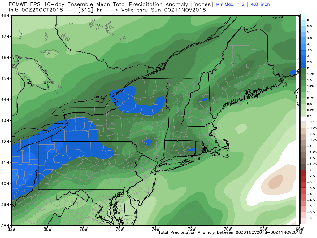
1-2″ of rain is possible with the late workweek storm system. November will get off to a wet start, and that’s nothing new in Southern New England with well above-normal precipitation in the past few months.
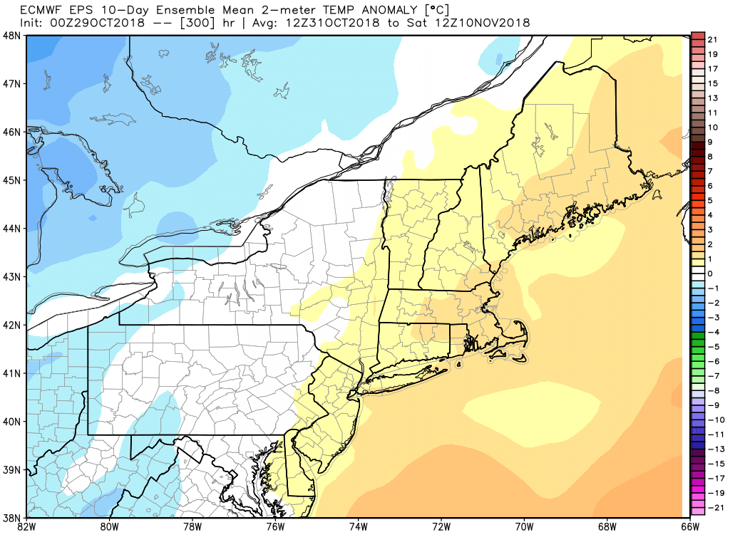
Aside from Wednesday morning, there is little chance for near freezing weather in the next 7-10 days. A chilly weather pattern in mid to late October gives way to relatively warm weather in the next week or two.