It took a while, but cooler air is finally moving into Southern New England on a northeast breeze Friday morning. The temperature was between 55-60° in most towns at dawn, and it will only be in the upper 50s to mid 60s this afternoon with a fresh northeast breeze that will make it feel cooler. The best chance of mid 60s is in Connecticut. Gray skies will give way to some sunshine.
Expect a chilly night as the wind diminishes under mainly clear skies. If you’re going to the Sox-Yankees game at Fenway Park, dress for the 50s on a nice night for some postseason baseball. The low temperature will be in the mid to upper 40s in most towns Saturday morning. Some of the normally colder locations may get to near 40°. The coast will be closer to 50°.
Saturday will be a pleasant day with highs in the upper 60s inland and low 60s near the coast. The low temperature Sunday morning will not be quite as cool as Saturday, but should still be comfy with it reaching the upper 40s to low 50s. Expect more clouds on Sunday, but it will also be warmer, with highs in the low to mid 70s. We’ll take a step back from the warmth on Monday as showers threaten and the temperature stays in the low to mid 60s.
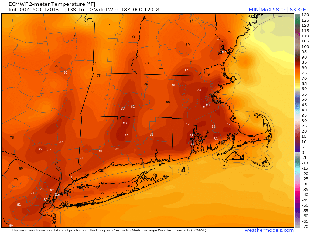
80s possible inland in the middle of next week
The middle of next week looks very warm for mid-October, with highs in the 70s coast to possibly 80s inland. Low temperatures may not get below 60°. A front brings a chance of rain late in the workweek. Conditions remain favorable for a storm to develop in the Gulf of Mexico. A tropical depression or tropical storm may form by early next week. The early outlook is for it to stay well south of New England through next week – as long as the front which arrives in our area late in the workweek does not scoop it up and bring it north.


