A brief cool-down is moving into Southern New England this evening with scattered showers as a front passes by and shifts the wind to the northeast for Monday. Expect temperatures in the 50s to mid 60s with plenty of clouds, but likely dry skies on Monday.
It gets muggy and relatively warm again very quickly. Tuesday will be in the 70s with partly sunny skies. Dew points will reach the mid to upper 60s. Expect it to stay very warm for mid-October through the midweek. Lows will be well into the 60s, and highs may reach 80° inland both Wednesday and Thursday. Patchy mist and fog is likely in the morning before yielding partly sunny skies in the afternoon.
Showers and thunderstorms are possible late Thursday into Thursday night as a cold front brings a late workweek cool-down. Right now, Friday looks like a cloudy and seasonable day with highs in the low 60s. The timing of tropical storm Michael coming out of the Gulf of Mexico and across the Southeastern United States is somewhat uncertain. It’s closest pass to New England will happen either Friday or Friday night. Right now, the track favors a glancing blow at worst, but it could shift a little closer and that would mean heavy rain and gusty wind for part or all of CT, RI, and MA. Given the offshore track, the most likely areas to have an impact are Cape Cod and the Islands.
Michael may become a hurricane as it moves through Gulf of Mexico and targets the Gulf Coast near the Florida Panhandle Wednesday or early Thursday. It will weaken as it crosses Georgia and the Carolinas before reemerging off the Mid-Atlantic coast late in the workweek or early next weekend. Obviously, the track of the storm is very important for New Englanders, so I will be watching it very closely. At this point, it looks more like a near-miss, but I’m not sold on that just yet. In any event, next weekend looks cooler, with highs in the 50s Saturday and Sunday. If the storm passes out to sea, Sunday morning could be in the 30s under clear skies.
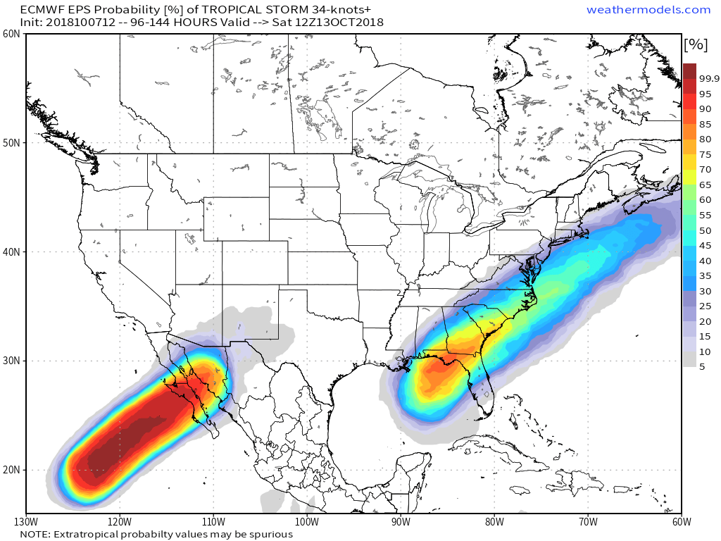
The most likely track for Michael is from Florida through the Carolinas and out to sea south of New England. If the center comes close to Nantucket, there will be some rain and wind in Southern New England.


