Showery weather on Friday gives way to steadier rain Friday night into early Saturday. Another 1-2″ of rain is possible in all of Southern New England. It has been a wet few months, and I expect more of the same in November.
The rain threat does not completely end until around midday on Saturday, but it’s possible that most of Saturday morning will be dry. It all depends on how quickly a storm develops over Boston heading into the Gulf of Maine. That rapidly developing storm will bring gusty winds Saturday afternoon and evening. There could be northwest gusts over 40 mph if it gets really cranked up. Look for temps in the 60s to start on Saturday, but falling into the 40s during the afternoon as it dries out with the active wind.
The wind diminishes Saturday night, and Sunday looks like a nice day. Expect sun with highs in the low 50s. The sunset is around 4:40 pm after we set our clocks back an hour to mark the end of Daylight Saving Time Saturday night.
Dry and cool weather is ahead for Monday before another storm system threatens with showers in the midweek. The frontal system will likely swing the wind around to the southwest and pump in warmer air. Expect highs in the 60s Tuesday and Wednesday – even with some showers around.
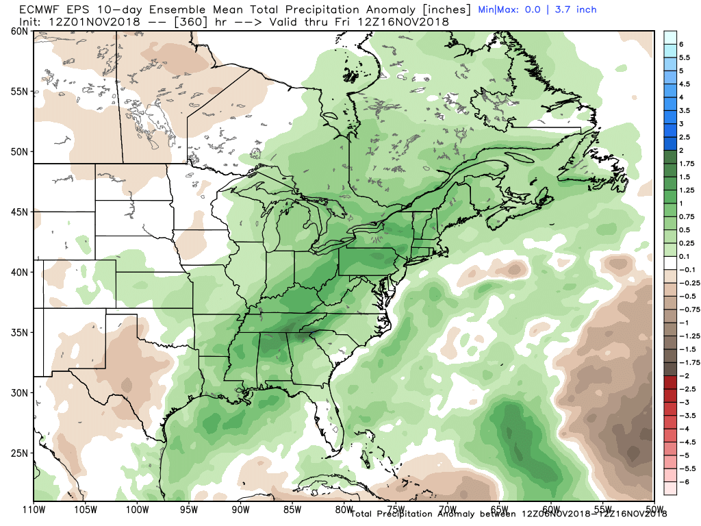
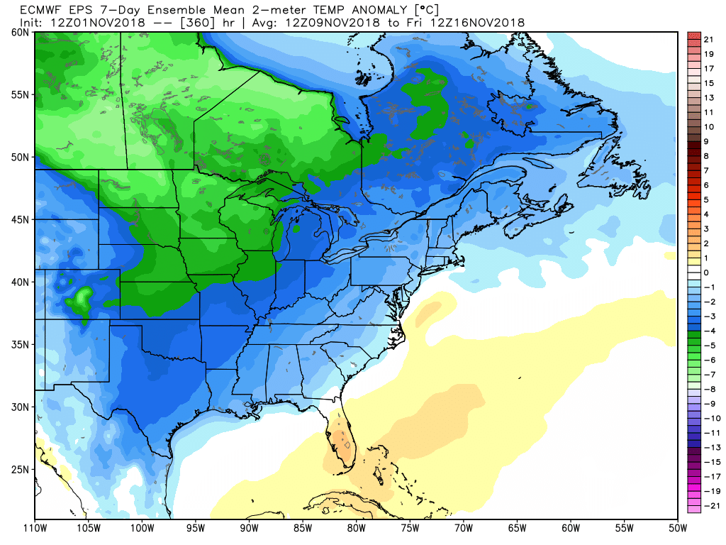
The long-range outlook for late next week into the middle of November is for colder weather to head east from the Midwest. The weather pattern may stay fairly active, so expect above normal precipitation in the first half of the month.