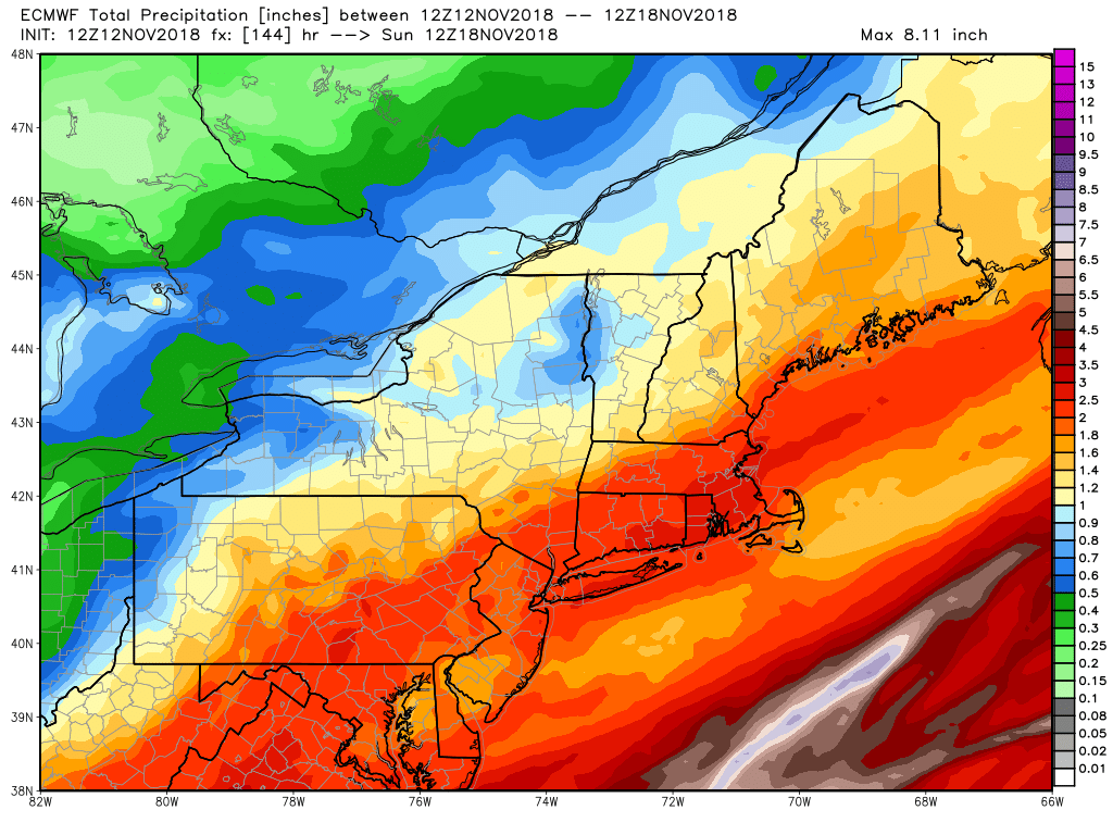
Another rain storm is on the doorstep this evening. Expect rain to develop by around or shortly after midnight and get heavier late at night. Moderate to heavy downpours are ahead for Tuesday morning, with the rain tapering during the afternoon. It may briefly get windy near the coast of RI and in SE MA. Expect 1-2″ of rain in all of Southern New England.
The rain is followed by a cold shot in the midweek. The temperature falls below freezing overnight Tuesday. Watch out for slippery, frozen leaves early Wednesday morning. Highs may not reach 40° Wednesday or Thursday with dry skies hanging on through most of Thursday.
A Thursday night into Friday storm threatens us with some snow/sleet at the start before a change to rain. It’s not a great setup for a snow storm as milder air should intrude and change frozen precipitation to rain Thursday evening. A minor snow accumulation is possible if the cold air can hang on long enough during the first burst of precipitation after sunset. It should be all rain after midnight, and once again a decent soaking is likely. In fact, by the weekend, most of Southern New England will have received 2-3″ of rain between the two storms.
The storm track for the Thursday night into Friday storm is uncertain, and a wiggle west or east would change how much snow/sleet makes it into Southern New England. Right now it does not look like much frozen precipitation near the coast before the change. If the storm tracks farther east than currently projected, that is a colder/snowier scenario. A track farther to the west takes snow/sleet out of the equation as easterly winds bring in milder air ahead of the storm. Let’s get through the Tuesday storm before getting too specific on the Thursday night forecast.
The early outlook for the weekend is for dry and seasonably cool weather with highs in the 40s both days. Believe it or not, a mainly dry stretch of weather is possible from this weekend through the Thanksgiving holiday. A few weak storm systems are possible next week, but it does not look like any storms like moisture-laden soakers we’ve been seeing are on the way for Thanksgiving week.


