Happy Veterans Day to all that have served our country. We are all indebted to you. Today will feature sunshine followed by late-day clouds. It will be seasonably cool with highs near 50° following a sub-freezing start to the day. Clouds thicken this evening with rain arriving around midnight in Connecticut, and shortly after midnight in Rhode Island and Eastern Massachusetts.
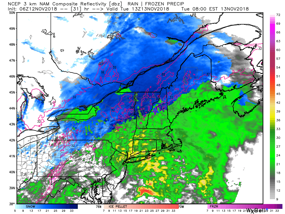
Another slug of moderate to heavy rain is ahead for Tuesday. The rain will be steadiest in the morning before gradually ending from west to east during the afternoon. 0.75-1.5″ rain is likely. The temperature will reach the upper 50s at the coast, and low 50s inland.
Cold weather arrives in the midweek. Expect temperatures in the upper 30s to low 40s – at best, with a gusty northwest wind making it feel even colder. Look for partly cloudy skies. The wind relaxes Wednesday night and the temperature dips into the 20s – one of the coldest nights of the season, so far. Thursday looks dry and chilly, with temps stuck in the 30s during the day.
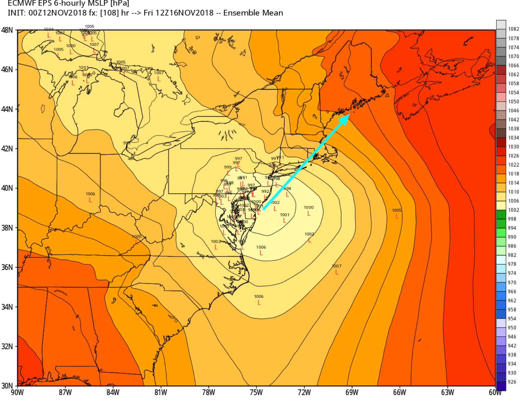
The cold air sets the stage for a possible brief brush with snow/sleet before a change to rain as another storm arrives Thursday night into Friday. The storm’s track is important, and the best bet for any frozen precipitation is north and west of Interstate 95, especially in the high terrain of CT and RI. At this point, I do not expect much of an impact from wintry precipitation Thursday night or early Friday before a change to moderate/heavy rain during the day. Another inch or more of rain is possible on Friday.
The Friday forecast hinges on the storm’s track. If it’s farther east than the current consensus, that will lead to a colder/snowier scenario. It’s still very early in the game, as we have the Tuesday storm to get through first. This active stormy pattern over the past few weeks has seen a very gradual shift east in the prevailing storm track. I’m leery of that continuing on Friday and leading to a colder scenario. While it’s unlikely to be all snow/sleet, there could be a longer period of wintry precipitation before a change to rain. I will be watching the trends closely early this week.
Next week, of course, is Thanksgiving and the big travel days leading up to it. Early indications are that the weather will settle down a bit, with temperatures moderating and a less stormy pattern in the Eastern United States. That’s good news for anyone traveling before the holiday.


