The temperature made it into the upper 30s to mid 40s in most of Southern New England on Friday, and that helped melt some of the snow that fell Thursday night. It was the biggest November snowstorm in 29 years in Providence, and 16 years in Hartford. Providence is now up to 7.61″ of precipitation this November, making it the 6th wettest on record with two full weeks to go. The record wettest was in 1983 when 11.01″ of precipitation fell. It’s possible that There’s a good chance this year makes it to second wettest. Another 3.5″ of precipitation is not out of the question, but a mainly dry stretch ahead will make that difficult to reach.
The weekend will feature dry skies and cool temperatures. Normal highs are in the low 50s, and it will be in the 40s on Saturday and struggle to reach 40° on Sunday. Expect sun and clouds on Saturday. It looks mostly cloudy on Sunday.
An Alberta Clipper system passes through Sunday night into Monday. A minor snow accumulation is possible in far northern CT and central/northern MA. A few light rain showers are possible closer to the coast. I will be watching the track of the system this weekend. If it’s a little farther south than currently expected, that could bring snow showers closer to the coast. The best chance of precipitation is from late Sunday evening until late Monday morning. It looks light and spotty.
Monday afternoon through Wednesday will be cool, but not as cold as Thanksgiving looks. Expect highs in the 40s Monday through Wednesday. A strong cold front opens the door to bitter cold weather on Thursday. Lows may be in the upper teens to mid 20s with wind chills in the single digits Thursday morning. It may not make it out of the 20s on Thursday afternoon!
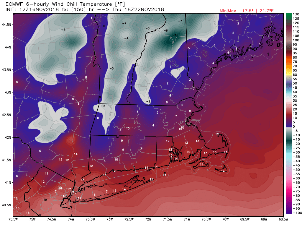
European model shows bitter wind chills on Thanksgiving day
The early outlook for Black Friday is for dry skies with a bitter cold start to the day. It may be in the teens at dawn, and rise into the 40s in the afternoon. I’m watching the potential for stormy weather by the end of next weekend. It’s a ways down the road, and it’s possible the stormy weather stays offshore, but it looks like it could be fairly active from next Sunday into the middle of the following week.


