The Thanksgiving week begins with a lot of clouds, a few stray showers, and temps near 50 on Monday. While not exactly warm for this time of the year, Monday looks like the warmest weather we’ll get through Thanksgiving, and possibly through the weekend, too. A weak system could bring a few showers, but I think for the most part it’s just a cloudy sky.
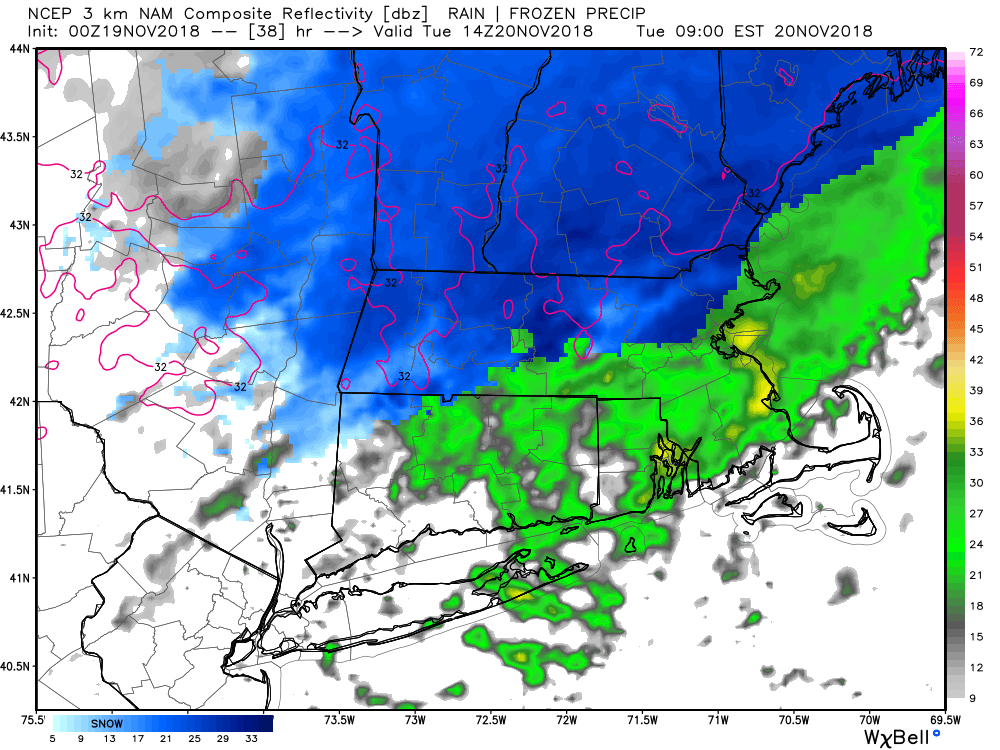
Another system follows on the heels of the first disturbance and brings mainly rain to CT, RI and MA on Tuesday. If you’re traveling north from the MA Pike into northern New England, there is a better chance of seeing snow. It looks like a moderate 3-6″ snow event in those areas. The best chance of any snow in CT or RI is near the northern borders with MA. If the center of the Alberta Clipper storm goes a bit farther south than currently projected, it will bring more snow into northern CT and RI. I will be keeping an eye on that.

Expect highs in the 30s to low 40s on Tuesday, with the “warmer” conditions near the coast. The temperature dips below freezing Tuesday night as skies clear when the storm departs. Wednesday looks cool and dry, with highs in the low 40s. An Arctic cold front brings near-record cold for Thanksgiving and Black Friday. The temperature nosedives into the teens by dawn on Thursday. It will be accompanied by gusty winds, and wind chills near zero. A few flurries or snow squalls are possible Wednesday night or early Thursday as the bitter cold air arrives. It’s probably will not reach 30 on Thanksgiving, and the wind makes it feel much colder.

Thursday night looks frigid for November, with lows in the teens under clear skies. Friday will be quite cold, too, as the temperature struggles to get to the low 30s. There should be sunshine and less wind. The first half of next weekend does not look bad. After a cold start, it will reach the mid 40s to low 50s on Saturday with increasing clouds.
The weather pattern looks stormy late next weekend into the middle of the following week. A couple of storms are possible. Right now, the pattern favors more rain than snow, but it bears watching for a colder scenario.


