Rain chances increase overnight tonight. If you’re heading out this evening, you may have to dodge a few showers, but the heavier rain holds off until after midnight. A line of downpours with gusty southerly winds and possible thunder/lightning will move through Southern New England from west to east between 2-8 am Saturday. It looks like there will be 0.75-1.5″ rain in CT, RI and SE MA. The temperature stays in the upper 50s to mid 60s overnight.
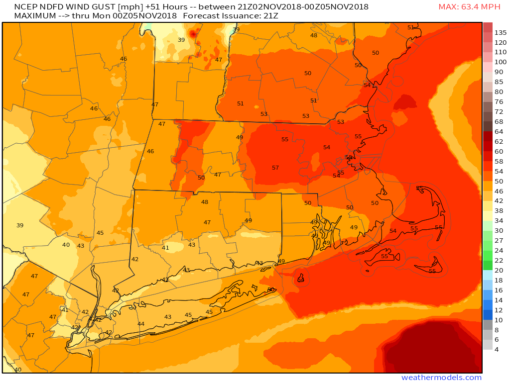
A few showers are possible after 8-10 am on Saturday until around 12-1 pm. The best chance for rain between 10 am – 1 pm is in northern CT and RI. It’s the back side of a rapidly developing storm system that will bring strong winds Saturday afternoon. Expect northwest winds 15-25 mph with the potential for isolated 45-50 mph gusts in CT, RI and SE MA. There is a higher chance of strong wind gusts from central MA to Boston. Temperatures will tumble from the 50s midday Saturday into the 40s by late in the day.
The wind diminishes under mainly clear skies Saturday night. We get an extra hour of sleep as clocks go back an hour to mark the end of Daylight Saving Time. It will be in the upper 30s to low 40s at dawn on Sunday. Look for some sunshine and a seasonably cool and pleasant day. Highs will reach the low 50s without much of a breeze. It’ll be a nice day for a midday walk.
Monday looks cool with a few showers around, especially in the afternoon. Highs will be in the upper 40s to low 50s. It gets milder in the midweek, but the shower threat persists. It may jump back into the 60s by Tuesday afternoon or Wednesday. Right now, Thursday into Friday look dry, with an increasing threat of rain by late Friday into early Saturday. It will turn cooler late in the workweek.
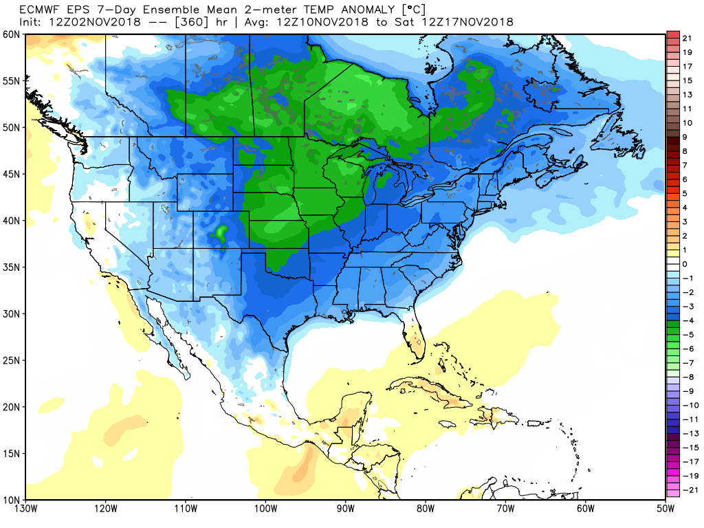
The early outlook for next Sunday is for dry and chilly weather. In fact, the weather pattern for mid-November looks relatively cool for most of the United States, with the coldest air focused on the Upper Midwest.