Thankfully, there is no more rain in the forecast for the rest of this month. Unfortunately, the first rain-maker of December hits this weekend. Expect a blustery couple of days in the midweek. Wednesday and Thursday will feature sun and bulky clouds with a gusty northwest wind that cranks up to 15-35 mph at times. High temperatures will be below normal in the low to mid 40s, and feeling more like the 30s because of the breeze. Lows will be in the 30s with the wind active Wednesday night.
A weak disturbance brings clouds on Friday. A few flurries cannot be ruled out. Highs will only be near 40. It stays dry on Saturday until at least late in the afternoon. Chilly air departs as the wind shifts to the southeast and a storm moves through the Midwestern United States. Saturday night into Sunday morning looks soggy with gusty winds and milder temperatures. It may actually punch into the upper 50s to low 60s on Sunday. The rain could linger through a good chunk of the day on Sunday. That part of the forecast is pretty uncertain at this point.
It stays mild on Monday with temps in the 50s through midday followed by gusty winds and colder weather Monday night. The weather pattern looks pretty chilly between December 4-10, and some snow cannot be ruled out. It’s very difficult to pin down the day that a storm may hit and bring some element of wintry weather, but it looks like mid to late next workweek is ripe for some action. It may not be a big event. I’ll be keeping a close eye on anything that develops!

2-3″ of rain likely in the next two weeks – that’s above normal
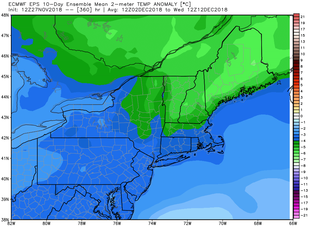
Mostly colder than normal likely in between Dec 4-10


