Tuesday may start without any rain, but there are more showers ahead for the afternoon. Even though it will likely not be “rainy”, it could be damp at times with patchy drizzle and mist as the temperature climbs into the upper 50s to low 60s by midday. There is a better chance of rain in the afternoon and early evening, and a thunderstorm is possible. Another 0.5″ of rain may fall in all of CT, RI and MA.
Dry skies return with some sunshine on Wednesday. It will be seasonably mild with highs not too far from 60. It cools a bit as it stays dry on Thursday. Look for highs in the low-mid 50s. Clouds return on Friday, but showers should hold off until at least the afternoon. Some rain is likely Friday night, and it may be heavy at times as a front sweeps through. It gets mild again for a few hours before a cool-down follows for the weekend.
Saturday looks brisk with temps 45-50 and partly cloudy skies. Sunday will likely be dry, with highs in the 40s. The long-range outlook is for colder weather next week. There could be several days in the 40s, and maybe even a day or two with a high temperature near 40. Of course, with so much cold air around, we need to watch storm tracks closely. Some snow cannot be ruled out in the middle of next week. It’s not the most likely scenario, but it’s in the discussion.
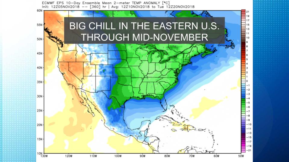
Expect temperatures to run well below normal between November 10-20. All of the Eastern United States will feel the chill!