It stays dry on Thursday, but do not expect it to be as warm as Wednesday was. Look for highs in the mid 50s with a blend of clouds and sun. There will be a 5-10 mph westerly breeze. Overall, it’s more typical of early November than Wednesday was. The dry weather hangs on through about midday Friday in Connecticut, and until late in the afternoon in Rhode Island and Southeastern Massachusetts.
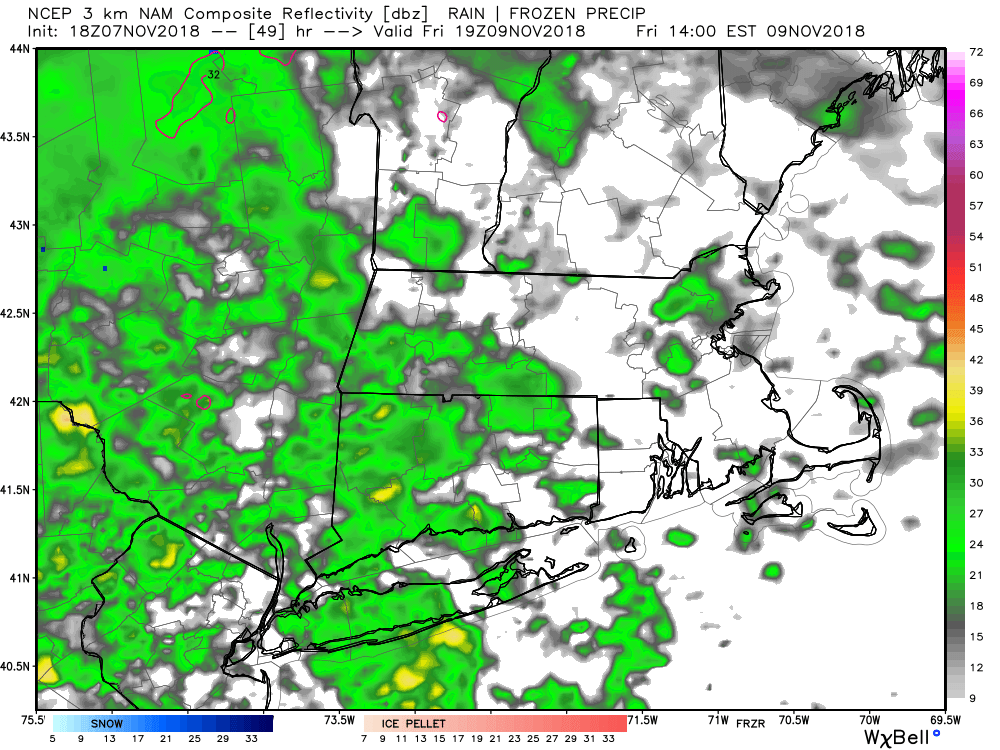
The above radar simulation shows 2 p.m. on Friday. Notice how there are showers over CT, but not too much going on over RI and SE MA. The rain will spread east by sunset, and it looks wet, with heavy downpours possible Friday night. The temperature will reach the 50s near the coast on Friday, but may stay in the 40s inland. Expect a raw, breezy and wet Friday evening if you’re heading out on the town.
0.75-1.5″ of rain is possible between Friday afternoon and early Saturday morning. Any rain should move out of the picture early Saturday, and the day looks dry and windy. The temperature will struggle to reach 50, with wind gusts between 20-30 mph as chilly weather arrives for the end of the weekend.
Sunday looks partly sunny, but brisk and chilly. Lows will be near freezing Sunday morning, and the afternoon will only be in the low to mid 40s. It stays cool on Tuesday with highs in the 40s after lows in the 20s. It will most likely stay dry through Monday evening before another storm arrives for Tuesday.
The Tuesday storm track favors rain in Southern New England. In fact, the temperature may spike to near 60 with gusty southerly winds. It looks like a soaker with 1-3″ rain possible. The storm will be followed by strong winds on Wednesday and much colder temperatures. It may reach the low-mid 40s, but it will feel colder because of the gusty wind. It’s early, but I think the wind may gust over 40 mph on Wednesday. Dry weather is likely Wednesday through Friday. You can expect a big chill, with highs struggling to get out of the 30s on Thursday and Friday of next week. It looks like the temperature will stay below normal through next weekend. Right now, snow is not imminent, but it certainly bears watching for some early season snow with plenty of cold air in place in mid November.


