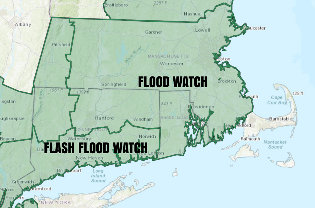
A two-day dry stretch ends on Friday as another soaking rainstorm brings heavy showers from late in the day through Friday night. A Flash Flood Watch is in effect for the Southern Connecticut counties, and a Flood Watch is in effect for most of the rest of Southern New England. 1-3″ of rain is possible with this storm, with 1-1.5″ the most likely scenario. That will be enough to cause big puddles on the roads, but probably not widespread flooding. If rain totals exceed 2″, then some rivers and streams may rise and lead to more flooding. It will be a raw day with temperatures climbing into the 50s near the coast, and into the upper 40s inland.
The lion’s share of the rain will fall Friday night, and it will be mainly dry by 7-8 a.m. on Saturday. A secondary disturbance passing through on Saturday could trigger a few showers, but for the most part it will be a dry day. Expect a gusty westerly wind between 15-35 mph during the afternoon. The temperature will hover in the mid to upper 40s before falling into the 30s at night.
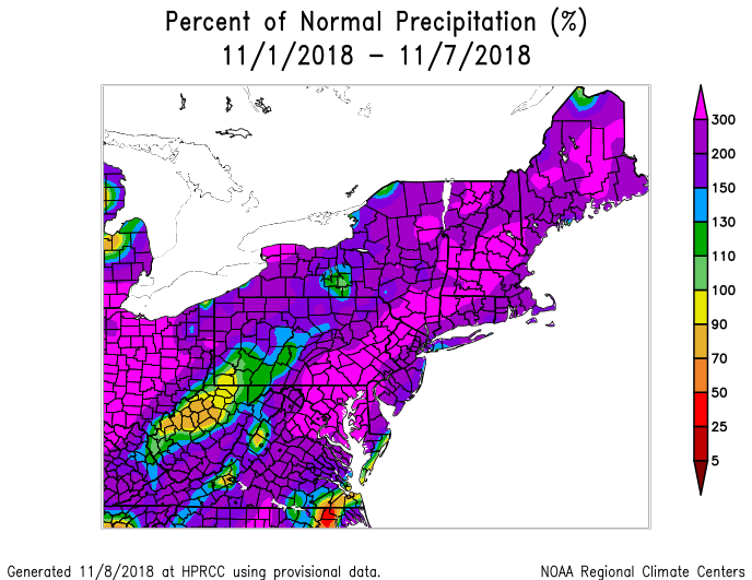
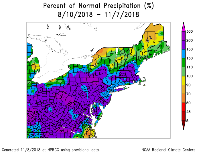
Rainy Pattern for Months
The month of November is off to a wet start, and that’s nothing new in Southern New England the graphics below represent rain departures from normal this month and over the past 90 days.
More Rain Next Week
The dry stretch between storms will not last very long. Expect a chilly Sunday with highs in the low-mid 40s and lows near freezing. There will be some clouds around and a fresh west-northwest wind – especially in the morning. The workweek starts with chilly and quiet weather on Monday. Clouds will gather after a morning low in the 20s. Look for a high near 50 in the afternoon.
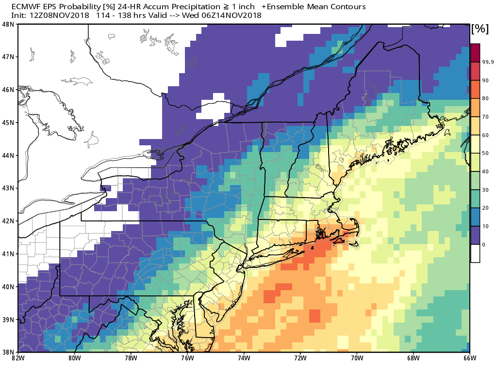
The next storm arrives early Tuesday and likely lasts through most or all of the day. A very brief period of snow/sleet is possible inland at high elevations. IF it happens, I do not expect it to amount to anything or lead to hazardous travel. The temperature will eventually climb into the 50s or low 60s near the coast, and there may be strong southerly winds.
The early outlook for the mid to late workweek is for dry conditions, and unseasonably cold temperatures. Highs will not be far from 40 degrees – more than 10 degrees below normal.


