It’s raining again. What else is new? A soggy November continues with another soaker Friday night. The good news is it’s out of the picture early Saturday after delivering 0.75-1.5″ rain to Southern New England. The weekend will feature chilly weather, and a gusty breeze on Saturday. Look for peak gusts 30-40 mph in CT, and 35-45 mph in RI Saturday afternoon and early evening. The temperature stays in the 40s for most of Saturday, but it will feel colder with some clouds and the gusty wind.
Sunday looks cold (for November) and dry. Lows will be below freezing in many spots, and the high will not be too far from 40 in the afternoon. The wind looks lighter on Sunday. Dry skies continue through Monday with highs in the 40s.
Yet another rain storm hits on Tuesday. Expect heavy downpours with 1-3″ possible in Southern New England. Rivers and streams will be running high, and more flood watches could be in effect. Unlike tonight’s storm that’s mainly at night, Tuesday will be a mainly daytime event. Strong winds are possible along the southern and eastern side of the storm, so the exact track will be important for Southern New Englanders.
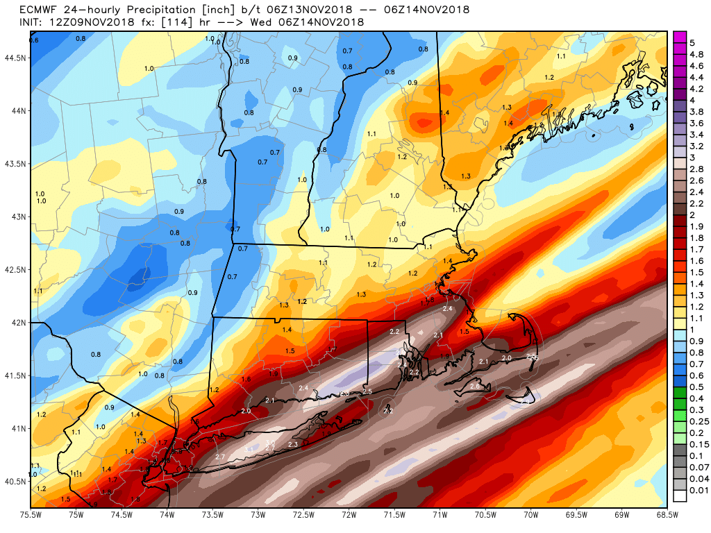
European computer model predicting heavy rain on Tuesday
Cold weather returns in the midweek, and the overall pattern looks pretty chilly through the end of next week. While there’s no snow imminent, it would not surprise me if we saw the first flakes of the season (even if they do not stick/accumulate) late next week. It looks like the relatively cold weather will ease a bit in late November – although, the normal temps are colder than, so do not expect anything too warm!


