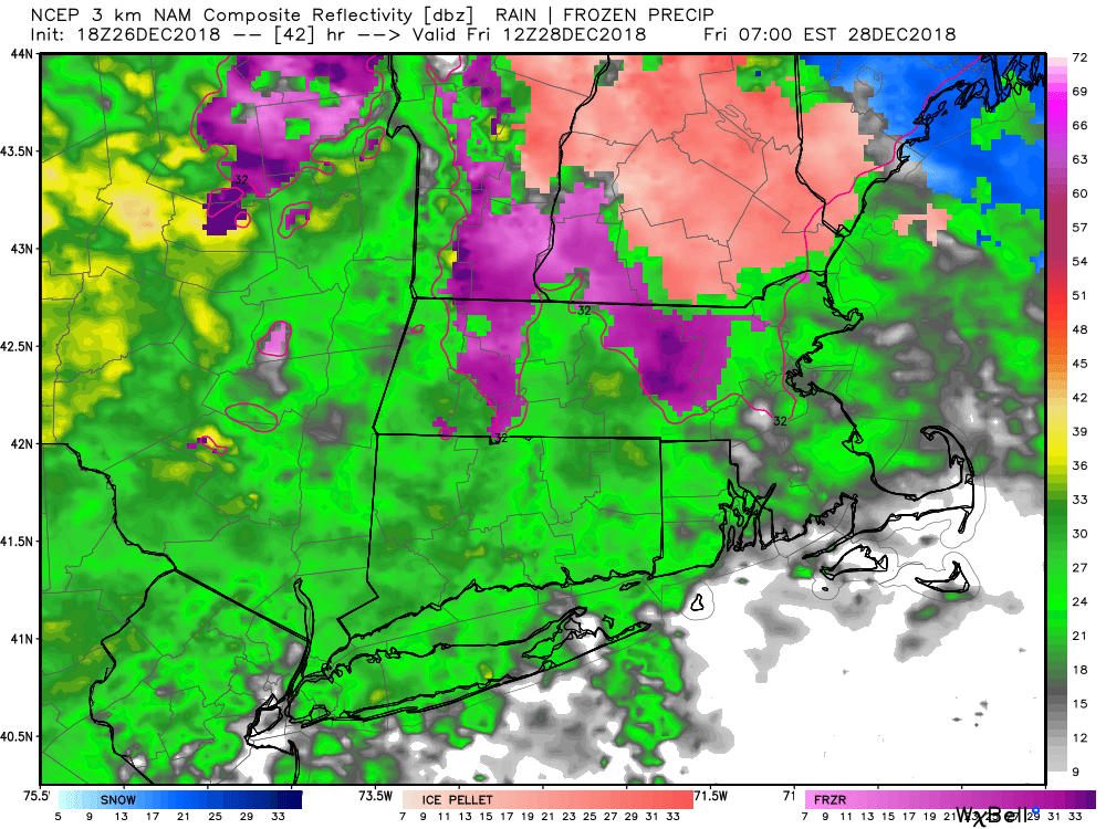
December is running near normal temperature-wise, but there has not been much snowfall this month. That’s not going to change with the storm system arriving Thursday night into Friday. Expect a mainly rain event for Connecticut, Rhode Island and eastern Massachusetts. A brief period of inconsequential snow/sleet may happen before a quick change to rain for most of the area. The snow/sleet and some freezing rain could last a little longer in interior Connecticut, and some slippery travel is possible in those areas early Friday. The I-95 corridor in CT, and all of RI and eastern MA will not have icy conditions as it looks like temperature will quickly rise above freezing.
Expect off/on rain during the day on Friday. The temperature will rise into the 40s, and may touch 50 near the coast. It looks like a decent soaker with 0.6-1.2″ rain likely. Rain ends earl Friday evening, and Saturday will be a dry day with mild conditions – highs near 50.
I’m watching a storm to our south on Sunday. It will most likely stay too far south for snow, but it’s worth keeping an eye on it. If it travels a bit farther north than expected, it could bring a quick light/moderate snow to at least coastal Southern New England. For now, the forecast is for dry skies on Sunday and Monday with temps in the 30s.
Another storm heads our way for New Year’s Eve. It may reach New York City before midnight and lead to a soggy start to 2019 in Times Square. The storm looks like a lot more rain than snow with another surge of mild air likely. The best chance of seeing some snow/sleet at the start is in inland Connecticut and Rhode Island. At this point, and it’s still early, precipitation may end or get lighter for New Year’s Day. Unlike last year when it was brutally cold, it may be unseasonably mild on January 1 this time around.
The early outlook for the first week of 2019 is for a close call with snow/rain in the Jan 3-4 time frame, and possibly another system late in the first weekend of the year. In fact, there could be three brushes with wintry weather in the first 10 days of the year. The current pattern does not favor all-snow events, and those systems also look like a close call between snow/rain.


