December 28 – Soggy New Year’s Eve
As expected, the storm system passing through late Thursday night into Friday had minimal wintry impact in Connecticut, Rhode Island, and Eastern Massachusetts. It will rain for most of the day on Friday, with it steadiest in the southern part of CT and RI. An inch of rain is possible in those areas. Temperatures will rise through the 40s during the day. Rain ends this evening, with fog developing overnight as it stays warm with the temperature hovering near 50 into early Saturday.

0.6-1.2″ rain expected on Friday in most of Southern New England
Saturday looks breezy and mild for late-December, with temperatures in the mid 40s. It will be partly cloudy. The weather stays quiet and turns colder Sunday into Monday. Highs will be in the 30s with lows in the 20s on Sunday. It will be in the 20s again on Monday morning with clouds increasing during the day and the temperature rising through the 30s.
If you’re heading out for New Year’s Eve, you will likely be contending with some rain from New York to Boston. Rain will develop early in the evening, and it looks steady as the ball drops in Times Square. It will be the same story for Southern New England. Temps will be in the 40s.

A wet weather map at 1 am on January 1, 2019
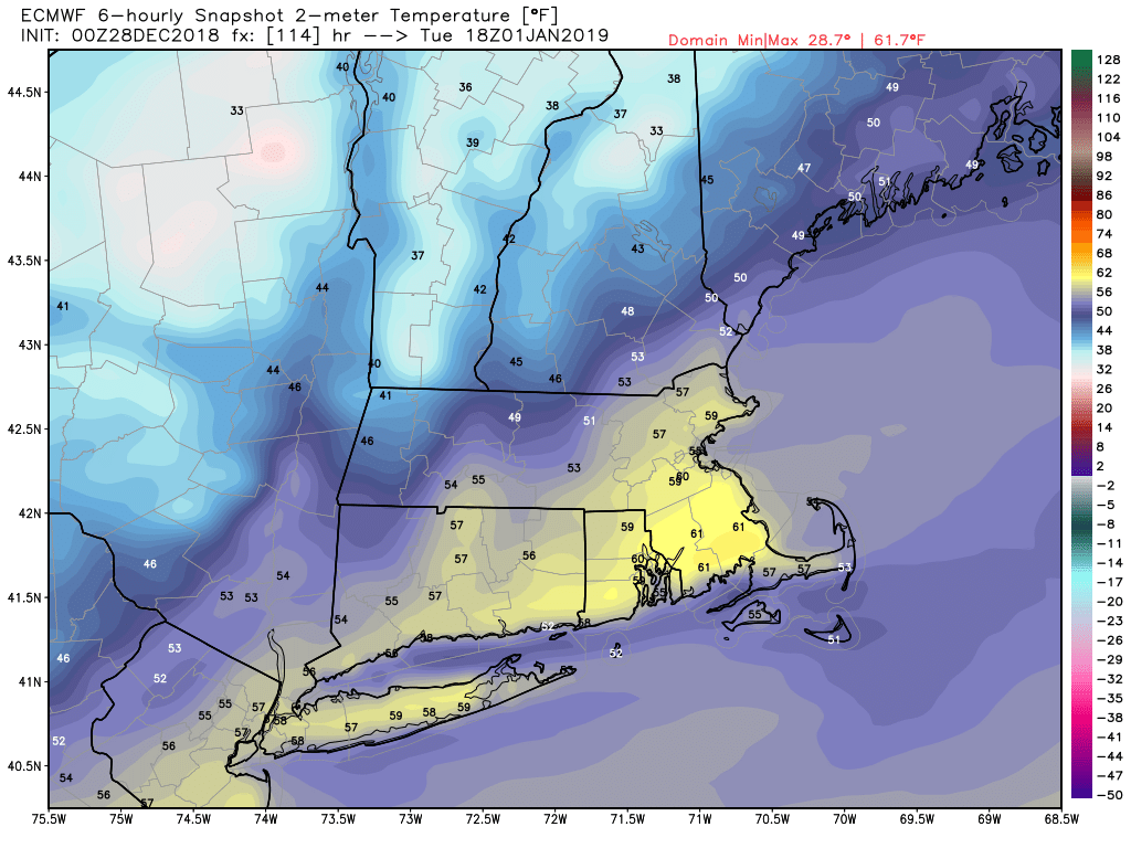
The storm will move away by early on New Year’s Day, and it looks a heck of a lot warmer this January 1 than it was last year. If the timing works out with some clearing, it could get to 60° in some spots! Last year was in the single digits with -10 to -20° wind chill. At a minimum, I expect upper 40s to mid 50s on New Year’s Day. It will be a breezy to windy day as colder weather slowly returns to Southern New England.

European model temperature forecast for 1 pm on January 1
The weather looks fairly quiet in the middle of next week. I will keep an eye on the potential for a storm or two over the Southeastern United States to move a bit far north than currently projected late next week.


