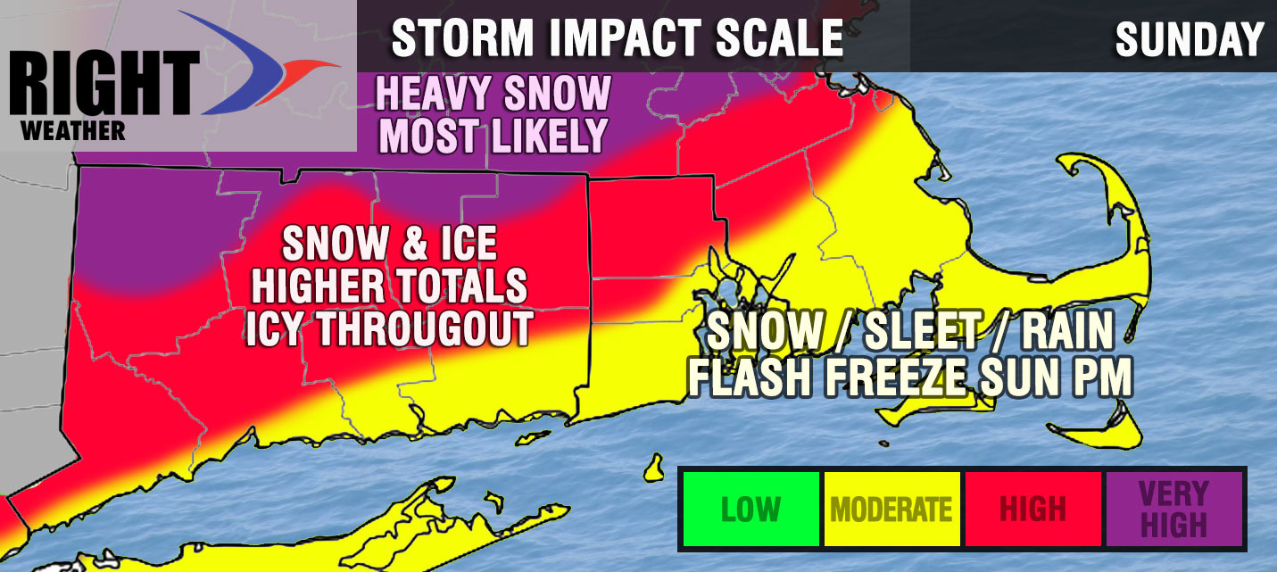
The latest trends for the weekend storm are for a colder moisture-laden storm that will bring a real mess to Southern New England. It’s still only Wednesday, and there could be big forecast changes, but the way it looks right now many in Southern New England will be dealing with a snow/sleet/rain/ice headache Saturday night into Sunday.
A colder track farther south means a few things:
- A longer duration of snow and sleet at the start of the storm
- Mild air does not get as far north, so more sleet and freezing rain inland with plain rain confined to the coast
- Cold air returns quickly on Sunday afternoon – may change mixed/icy precipitation back to snow before ending
- Flash freeze likely Sunday night as temperature nosedives through the 20s and 10s.
There are still several days to go before this event, and I will narrow the timeline and start talking about snow accumulation maps by late in the workweek. It’s too early to speculate a lot about snow totals because the difference between 3 and 9 inches of snow with this storm could be 20 miles. It is too soon to know where that line will set up.
I’ll have another update Thursday morning with the latest on the week Friday AM system and, of course, the bigger one this weekend.