The last day of February was also one of the coldest of the month. January 21 (MLK Day) was in the same ballpark – approximately 19-25° colder than normal. The first day of February also looks very cold with temperatures ranging from below zero to single digits at sunrise to the upper teens to low 20s in the afternoon. There will be a decent dose of sunshine, and the wind will not be particularly strong. After a frigid start, it’s not so bad in the afternoon. Expect another very cold one Friday night into early Saturday. Temps will dip into the single digits again for most, and some of the normally colder spots could be below zero again. Saturday afternoon will feature some clouds and a slight warm-up into the low to mid 30s – not exactly balmy, but heading in the right direction.

The warm-up looks slow and steady. At one point, it looked like Sunday would bust well into the 40s and maybe reach 50. I’m skeptical of that, and expect some clouds around and temps in the upper 30s to low 40s – at best. There’s a better chance of reaching the 40s on Monday, and it may get to the 50s in some towns on Tuesday. We’re at the time of the year where the warm-up can be felt more inland than near the coast if the wind is onshore. Right now, it looks like a light breeze early next week, so it’s possible everyone gets close to 50° at some point.
Up and down we go
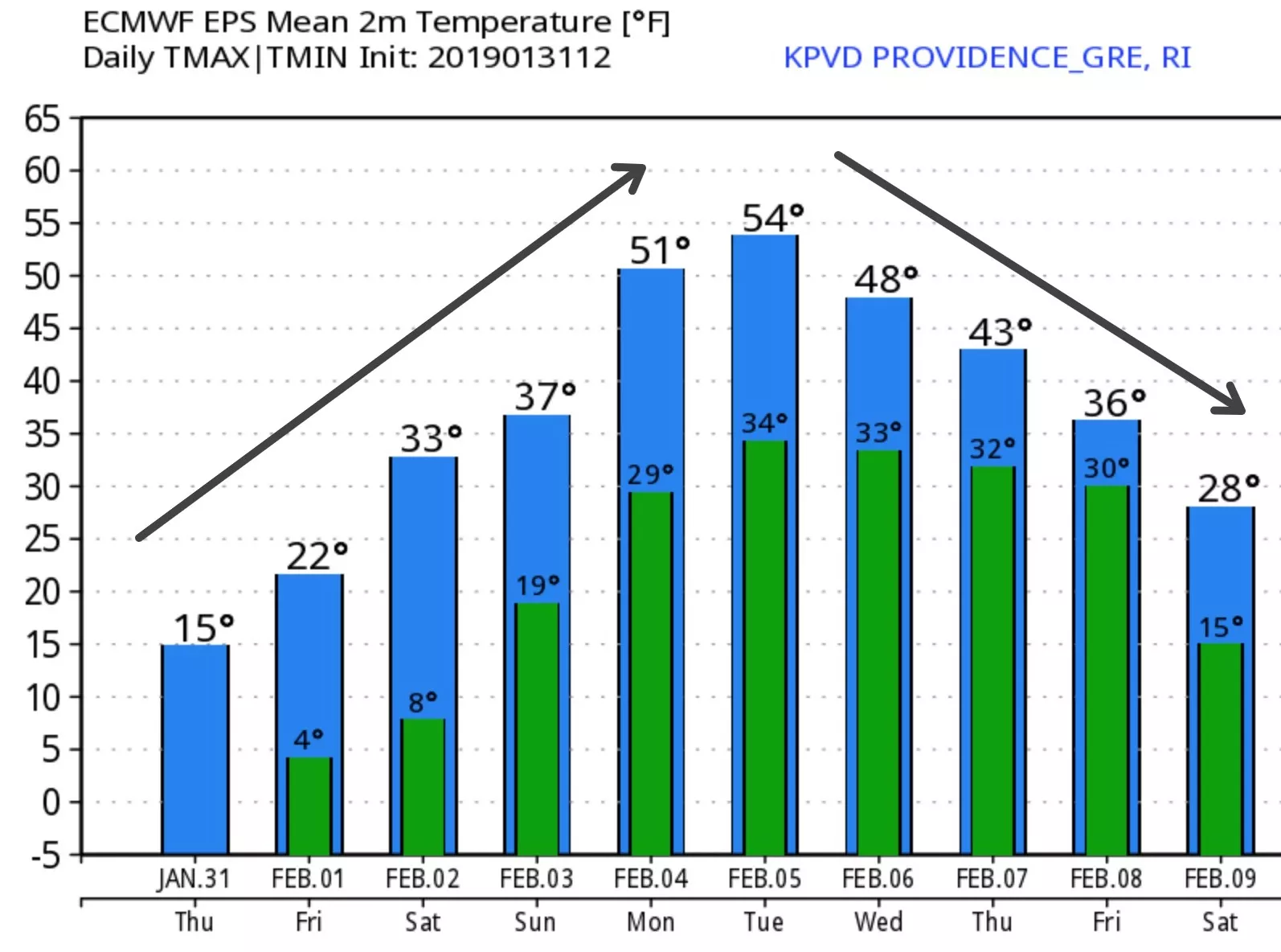
Early-February warm-ups are usually not long-lived, and this one will be no exception. Expect the temperature to tumble from the 40s Wednesday to seasonable 30s by next Friday and maybe even colder next weekend. It looks like we’ll have some rain to deal with late next week. I shared a graphic in the private Facebook group showing a 0% chance of 3″+ snow in the next 10 days. That’s remarkable to see it at nil. Even in a warm pattern, I would expect to see a 10-20% chance of some snow in a 10-day stretch. So, the Euro is very confident (right now, anyway) that the potential Thursday-Friday precipitation will be mainly or all rain. The same model is still advertising increasing snow chances between Feb 11-15. As cold air returns, maybe the pattern will finally set up where the storms run into the cold air and produce snow rather than arriving just as the cold air is departing to the east. We shall see!