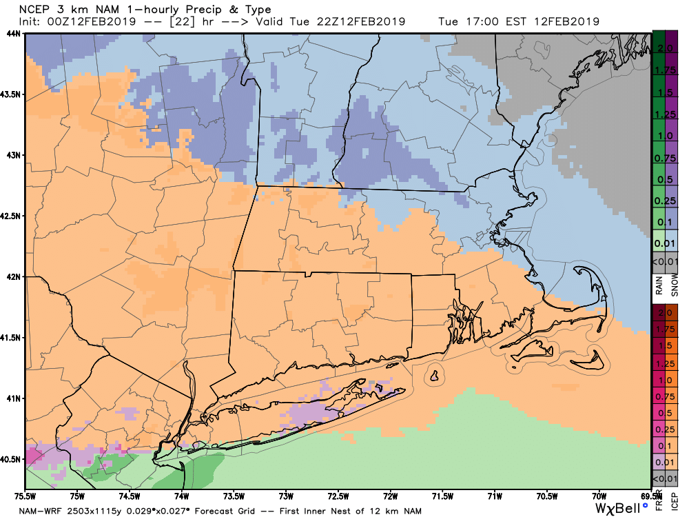
A storm system moving into the Northeast on Tuesday will bring a quick burst of snow followed by sleet, freezing rain and rain. The sleet may last for a few hours, and will probably last longer than the snow. Snow begins 10am-12pm in the western half of CT, 12pm-2pm from Eastern CT through RI, and after 2 pm in SE MA. Expect 1-2 hours of snow followed by 4-5 hours of sleet, and then freezing rain to rain.

The change from freezing rain to rain will happen quickly near the coast, but could take a few hours inland where some glaze is possible. The iciest weather will likely be in NW CT.
I really do not have too much new to say on this storm. The forecast has not changed much from my detailed outlook on Sunday evening. Most or all light rain and freezing rain is over by dawn on Wednesday. Snow totals still look good from Sunday night’s update.

Quiet weather is ahead for Wednesday, Thursday and most of Friday. Showers are likely on Friday – probably rain. The forecast for the weekend is not looking as clear cut. At first it seemed that the Friday PM into Saturday system would be basically one storm that brought rain and southerly winds. Now, it looks like the second system may lag behind the first and also take a track farther south. That suggests the potential for snow or a mixed event. It could also miss out to sea.

It’s something to watch for the rest of the week, and the models are insistent on more action next week. In fact, the EPS mean has a decent amount of snow in the next two weeks – although it is overestimating how much we’ll get tomorrow.


