February 16 – Sunday-Monday snow forecast update
It's not a big storm, but could be a nuisance if you're working Monday morning
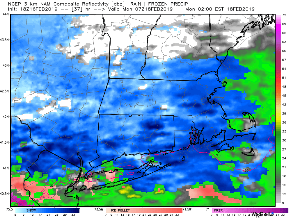
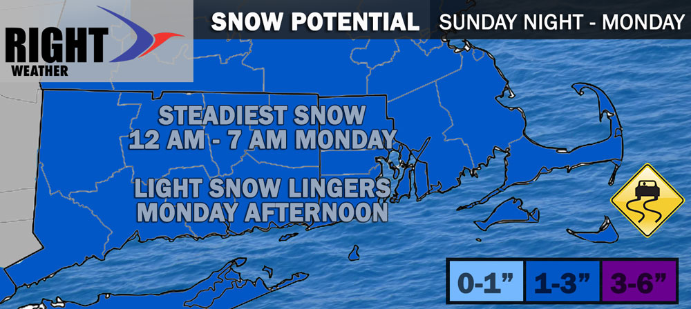
Snow-lovers are desperate for anything in a winter nearly devoid of snowstorms in Southern New England. A minor to moderate system brings a decent chance of accumulating snow Sunday night through Monday. The best chance of picking up 1-3″ of snow is before dawn on Monday, although snow will likely linger through the day on Monday. There is a lower chance of it accumulating very well during the day because it will likely be rather light, and with the temperature near freezing.

Timing
Snow develops from west to east across Southern New England Sunday evening. It may begin 9-11 pm at the CT/NY border, and should begin by around midnight in eastern CT and RI, and shortly after midnight in SE MA. As mentioned, the steadiest snow is likely late at night into early Monday. It’s a holiday and some schools are on vacation, so the morning commute should be lighter than usual. There is a decent chance that it will not be a speed limit ride on Monday morning because of the weather, and especially on the side roads. Allow extra time if you are traveling.

A tough of low pressure hangs behind the storm system as it moves away from the coast on Monday. Snow will taper to flurries either in the afternoon or evening. I expect most of the accumulation to happen before noon. Wind will not be a factor at all with this storm. There is a chance that some sleet mixes in late Sunday night and Monday morning near the coast, especially in Connecticut.

The temperature dips into the teens to low 20s Monday night as skies clear overnight.


