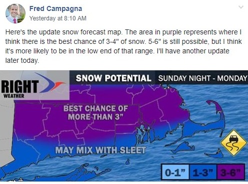
As it turns out, I should’ve just left well enough alone. The forecast snow map I issued Sunday morning turned out to be the closest to reality as we woke up this morning. See the screenshot from the Right Weather Pro private Facebook group from Sunday morning. Of course, I changed it to be a more widespread 3-6″ yesterday evening, and that certainly did not play out.
A thin layer of mild air made it into the southern half of CT and RI changing snow to sleet overnight. The snowflake growth in the areas that received all snow was not particularly impressive, and that’s why the totals there are mainly in the 2.5-4.5″ range instead of 5-6″.

I’m kicking myself for buying into short-range models yesterday evening that were projecting this:

This is a computer model that runs every hour, and this forecast is from approximately 11 pm last night, when it was already not going well at all in Fairfield County, CT. The model was insisting on 4-5″ throughout RI, and it’s usually fairly accurate. It’s a hard lesson that we are reminded of every winter, but even as technology advances, the atmosphere is still a chaotic system and impossible to perfectly model. In this case, the model was too cold a few thousand feet above the ground, and predicted snow instead of sleet. It was probably 1-2° C off the actual temperature – that’s not a big error, but when it takes it from freezing to slightly above, it makes a big difference in what you see in the morning. Had this been a rain event, the forecast would’ve been very good. Fill in your joke here.
Turning the page
A lot like a quarterback who just threw an interception or a baseball player who struck out twice in a row, meteorologists need to have a short memory and not carry past failures with them. So, I’m already on to this afternoon and Wednesday.

Flurries and snow showers linger through the day – especially in RI and eastern MA. Another coating-1″ is possible, but the snow will have a hard time sticking to bare pavement during the day. The last of the snow showers and flurries move out between 6-8 pm in CT, and 7-9 pm in RI and E MA. The temperature falls into the 20s by midnight, so watch out for slippery spots tonight and tomorrow morning.
Tuesday and most of Wednesday will be dry and rather cold. Temps during the day may struggle to get above 32° inland, and probably only reach the mid 30s at the coast. Tuesday looks like a bright day with lots of sun glare in the morning and evening. Grab the shades for the commute. It will be in the teens to low 20s Tuesday night.
Clouds increase on Wednesday ahead of the next storm system that will bring (you guessed it) a wintry mix Wednesday night. Snow develops in the evening, but will change to freezing rain and rain overnight. It looks like a decent chance of an inch of snow before mixing, but a pretty low chance of more than three inches. So, it’s a minor snow amount before sleet and freezing rain. There could be some glaze, especially inland at night. Eventually, the precipitation will likely change to rain for most – first near the coast and then heading inland. It may never get above freezing in northern CT and NW RI before the precipitation ends around dawn on Thursday. The temperature shoots through the 30s into the 40s (maybe even 50s) on Thursday afternoon with dry weather.
I will continue to watch this closely over the next couple of days. There’s still more than a month before spring and more snow chances. If you’re interested in getting reports like this year-round, it’s just $3/month for all the rightweather.com content, and $5/month for that plus the private Facebook group for even more updates. Join now and you’re not billed until the end of the month.


