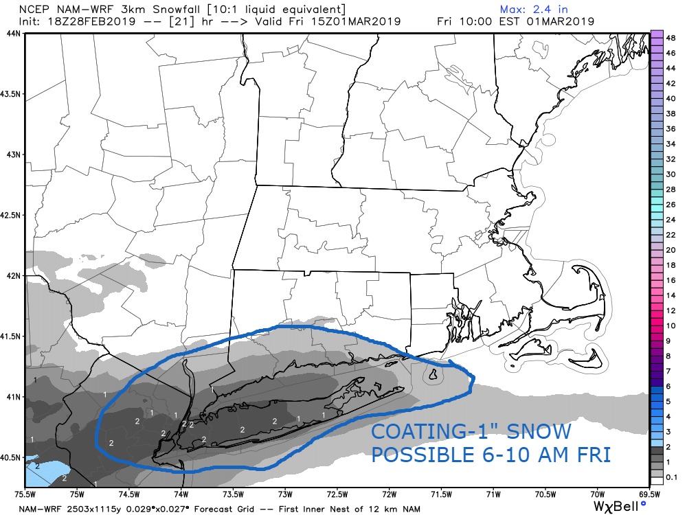
All of a sudden the winter weather pattern in Southern New England is hyperactive. Counting yesterday’s storm, it may snow on five consecutive days in Southern New England. The lion’s share of snow from last night fell in Rhode Island and Eastern Massachusetts. Tomorrow morning, there could be a very light snowfall along the Connecticut Shoreline into far southwest Rhode Island. It does not look like much, but a coating-1″ cannot be ruled out as a disturbance passes by to the south. The threat of snow is from 6-10 a.m.
It will stay mostly cloudy Friday afternoon with temperatures climbing into the mid 30s. Another weather-maker arrives in Southern New England late Friday night into Saturday. Like yesterday’s storm, the best chance of plowable snow is in Rhode Island and Eastern Massachusetts. This looks like a weak Nor’easter with the best chance of moderate snow and gusty winds around Buzzards Bay in Massachusetts. First flakes are possible near the coast around midnight, with the snow ending early Saturday in CT and lingering through midday in RI and SE MA. If the storm tracks a bit farther west than sleet becomes a bigger issue for Cape Cod, and the snow gets steadier/heavier in CT. Unlike last night’s tranquil snowfall, Saturday will have a 15-30 mph breeze near the coast – strongest in RI and SE MA.

The break between storm systems will not even last for 36 hours as the next storm, probably the strongest, arrives late Sunday into early Monday. Right now, the track of that storm favors snow to sleet to rain for a big chunk of CT, RI and SE MA. If the track shifts farther east, it becomes a moderate to heavy (but fast-moving) Nor’easter. I am not sold on such a warm track for this storm, and would not be surprised if the snow threat shifts farther southeast from where it is on the map. It may not get all the way to the coast, but the I-84 corridor and NW RI could pick up several inches of snow before sleet if the track shifts just a bit. The bulk of that storm is over before dawn on Monday, and there could be strong winds near the coast.

The weather looks unseasonably cold in the middle of next week. We should get a break from snow/rain, however, between Tuesday and Thursday. It’s hard to believe given the way this winter so far, but there’s a decent chance that Hartford is above normal for snowfall by Monday afternoon, and if the Sunday storm trends colder, then Providence could also be near or above normal. The deficit is bigger in Bridgeport, and it would take a big shift in the Friday night and Sunday night storms to really cut into it. Stranger things have happened…


