The very gusty northwest wind will diminish under partly cloudy skies Tuesday night. The temperature dips into the 30s to low 40s by dawn. Wednesday will be a nice day with highs in the mid 50s at the coast to near 60 inland.
A wind shift on Thursday ahead of a slow-moving storm system will bring clouds and possibly a few showers. It does not look like a washout. Patchy drizzle is possible near the coast with temperatures in the low to mid 50s. The best chance of coastal drizzle/mist is early and late in the day.
The storm gets a bit closer on Friday, and there is a better chance of showers in the afternoon in Connecticut, and evening in Rhode Island and Southeastern Massachusetts. It will become windy with highs in the 50s coast to 60s inland.
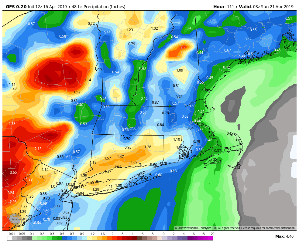
Rain is likely Friday night into Saturday. It may be heavy at times, and thunderstorms cannot be ruled out. Early estimates are for 1-2″ of rain in CT, and 0.6-1.2″ of rain in RI and SE MA, with less on Cape Cod. The rain threat may diminish by midday Saturday in CT, but could linger through the day in RI and SE MA. It will be mild and windy with highs near 60.

The storm should move away Saturday night, and the second half of the weekend looks a lot better. Expect highs in the low 60s with some sun. The weather looks fairly quiet in the early to middle of next week. Monday may be near 70 before it turns a bit cooler in the midweek.


