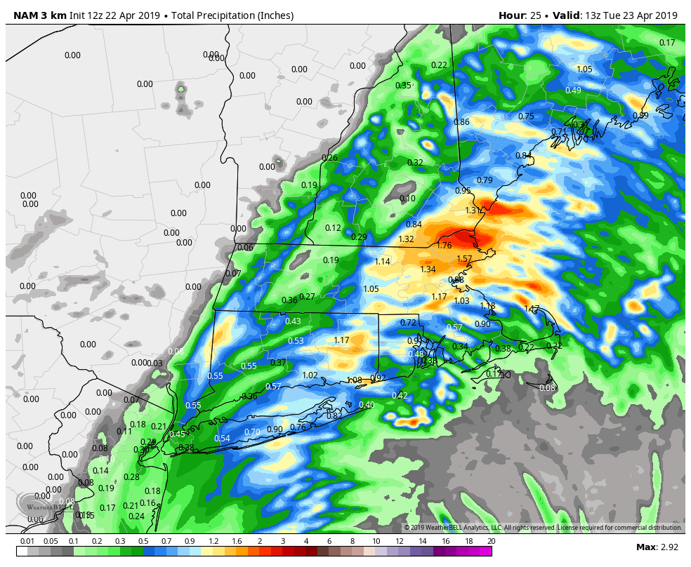
A storm developing south of New England will move overhead late Monday bringing another round of showers from late in the morning into the night. The rain may be locally heavy, with a few towns getting around an inch of rain, while others get closer to a quarter-inch.
The rain threat diminishes early Tuesday, and there will likely be a break from the wet weather during the day. Skies will be partly to mostly cloudy on Tuesday with highs in the low to mid 60s. It will not be long before showers return, however, with more rain possible late Tuesday night. It does not look like heavy rain, and the shower threat diminishes early Wednesday morning.
Look for some sunshine Wednesday afternoon with highs in the mid to upper 60s. Quiet weather is likely on Thursday with highs in the 60s under fair skies. A storm system approaching from the west late in the workweek brings rain back to Southern New England on Friday. At this point, it looks like Friday could be a washout with showers in the forecast all day into Friday night.
The early outlook for the weekend is for a break in the action on Saturday with highs near 60. Clouds increase again on Sunday as a front arrives. Light showers are possible late in the day. Highs will again be close to 60.


