Southern New England has received more than its fair share of April showers this month. In fact, it has been the second-wettest April on record in Hartford, CT. The other Southern New England stations with lengthy reliable weather records are also in the top-10 wettest.
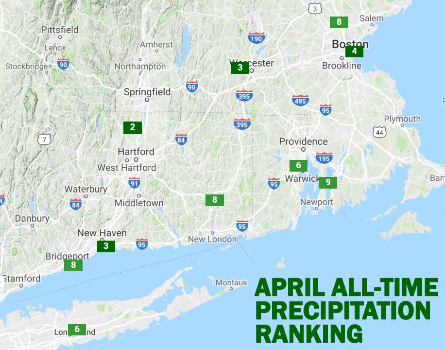
With just a couple of days left in the month, and dry weather on tap for Monday, it’s highly unlikely that Hartford will reach the top of the charts. April 1983 featured 9.90″ of rain in Hartford. This month currently sits at 7.78″, with another 0.1-0.2″ of rain coming Monday night into early Tuesday.
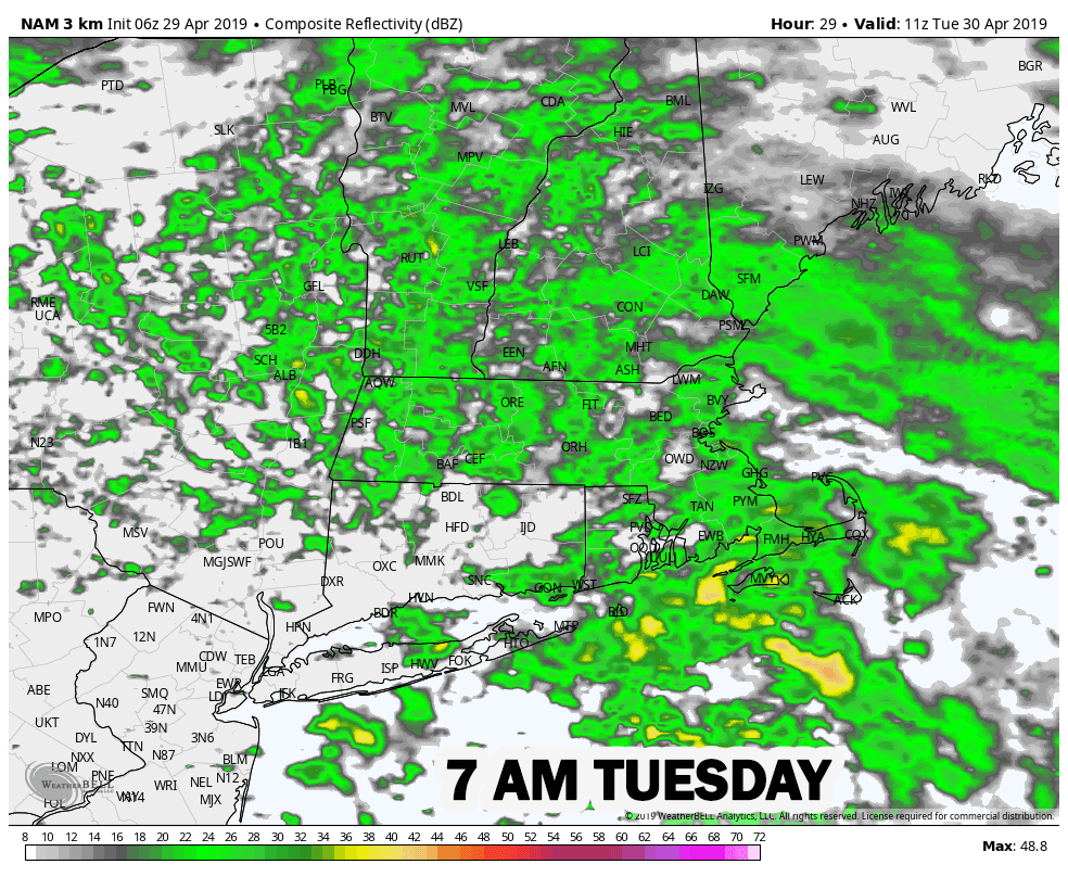
Expect morning sunshine to give way to clouds by late Monday afternoon. It will be a seasonably cool day with highs in the mid 50s. Showers return Monday night as a weak system moves through. Rain will be relatively light and ending Tuesday morning. It will probably not be enough rain to significantly slow down the AM commute. The shower threat diminishes by midday, with highs in the 50s on Tuesday.
Wednesday looks dry and cool, but the dry weather will not last for very long. Highs will be in the 50s again on Wednesday. In addition to being very wet, April has also been about 2 degrees warmer than normal. The last few days of the month and the start of May will be a bit cool. The normal high at this time of the year is in the mid 60s.
A front will be nearby late in the workweek and into the weekend. That means clouds will prevail, and there will probably be some showers, too. It does not look like heavy rain either Thursday or Friday, and there may be extended stretches of dry weather for several hours. It’s the kind of nuisance system that may keep it just wet enough to rule out yard work – especially in the morning when it tends to be damp. Highs will only be in the upper 40s to low 50s Thursday and Friday.
There is a lot of uncertainty about the forecast for the first weekend of May. Right now, there’s a reasonably chance that showers linger on Saturday with overall drier weather on Sunday. Highs could be close to 60 on Saturday and in the 60s on Sunday if the sun breaks through. Looking way down the road, we may finally catch a break from the unsettled weather in the second week of May as high pressure moves in from Canada bringing dry and pleasant weather.


