May 10 – Very cool and unsettled Sunday-Monday
The workweek is ending on a low note with a cool and showery day in Southern New England. We’ll turn it around briefly on Saturday with some sunshine and highs in the 60s. Unfortunately, the nice weather will not last through Mother’s Day.
Showers continue Friday evening, but steady/heavy rain is unlikely. The rain threat ends by dawn on Saturday, and it looks like a fine day with partly to mostly sunny skies and highs in the low to mid 60s with comfortable humidity and a west-northwest breeze. It is a fast-moving weather pattern, so the next storm system will already be developing over the Southeastern United States, and that is on the way as a 1-2 punch Sunday and Monday.

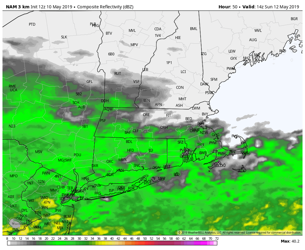
It looks like a glancing blow on Mother’s Day, but enough to bring in showers and very cool conditions for May 12. Rain could begin as soon as around sunrise. Look for temps in the 40s to, at best, low 50s if the rain stops. The best bet for rain is in Connecticut and near the coast of RI and SE MA in the morning. The rain does not look very heavy. A brief break is possible late in the day into Sunday night before rain returns for the start of the workweek. It will stay unseasonably cool early in the week.
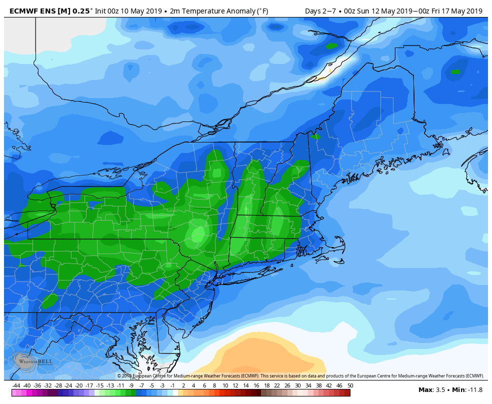
More showers, drizzle, and mist are likely on Monday. Look for temps to stay in the 40s on Monday with a northeast breeze. There’s a lower chance of rain on Tuesday, but it will not warm much with temps in the 40s to low 50s – instead of the normal high which is not too far from 70. The sky gets brighter on Wednesday, and the temperature should be closer to 60, but that’s still on the cool side.

Do not expect any big warm-up late next week. It should stay relatively cool through the end of the workweek, and the early outlook for next weekend is for seasonable weather with a chance of rain on Sunday.


