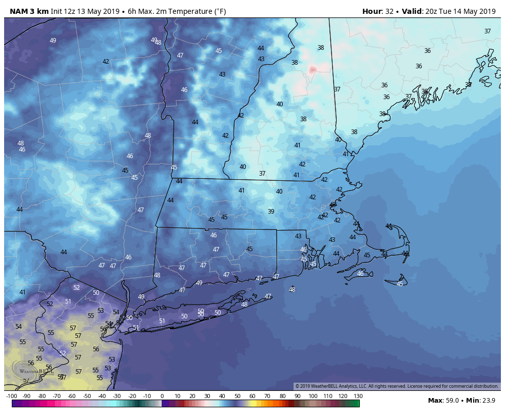
May 13 – Chilly Tuesday; Warmth not too far away
An extremely cool and unsettled stretch of weather continues with rain Monday night followed by a very cool day on Tuesday. The high temperature may not get to 50 degrees in some towns, and that is nearly 20 degrees below normal for this time of the year. In fact, only twice since 1905 has the temperature not reached 50 degrees on May 14 in the Providence area. The high was 47 degrees in 1948 and 48 degrees in 1931.
Most of the rain will end by dawn on Tuesday, but there will still be enough unstable air around for scattered showers during the day – especially early in the day in eastern New England and then again late in the afternoon in western CT. Most of the day will be in the 40s. The best bet for getting barely above 50 is in western CT in the mid-afternoon. Providence has a chance of setting the dubious “lowest high temperature” record for the date.

It will be baby steps to improvement on Wednesday. Look for clouds and some sun with highs in the 50s – still quite cool for mid-May. Scattered showers are possible Wednesday night into Thursday morning as a disturbance passes by. Thursday afternoon should be ok with highs in the 60s.
The weather looks fairly quiet late in the week through the weekend. Scattered showers are possible Friday morning with another disturbance passing by. It will not be very warm Friday afternoon with highs in the low 60s. The weekend is shaping up to be pretty good. Saturday will be partly cloudy with the slight chance of a pop-up shower. Highs will be in the low to mid 60s.
The early outlook for Sunday into early next week is for warm weather, with highs possibly reaching 70 degrees on Sunday, and it may get close to 80 by Monday or Tuesday afternoon. That may seem very warm, but it is actually closer to normal than what we’re having right now. By early next week, the normal high temperature is in the upper 60s near the coast and low 70s inland.


