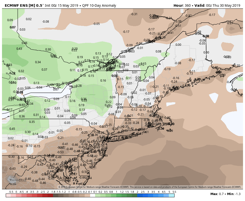
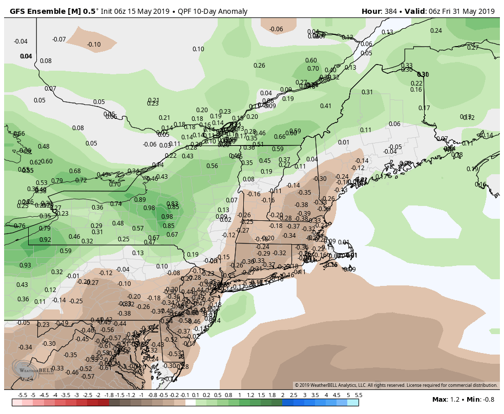
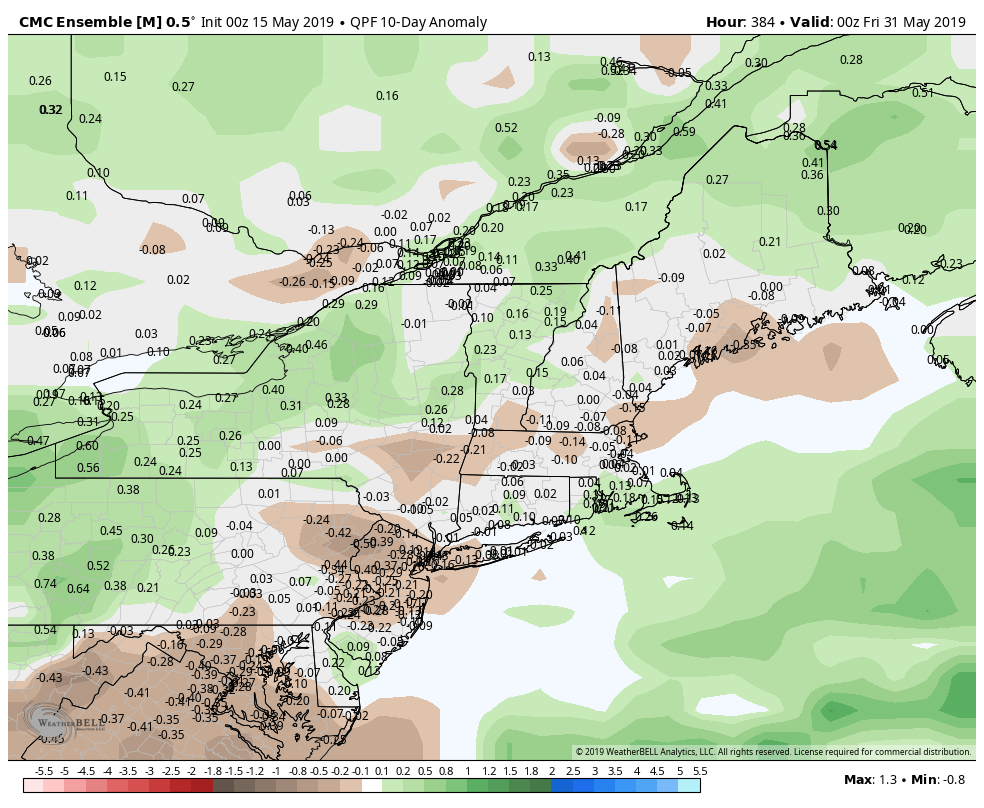
Two weeks after setting the record for most days with measurable precipitation in April, the weather pattern has not changed much in Southern New England. So far 12 of the first 15 days this month have featured measurable precipitation in Providence, RI. It’s quite likely that there will be showers at some point Thursday and Friday, so that total should reach 14 of the first 17 days. To put it in perspective, the record set last month was 21 of 30 days with measurable precipitation. That means if 7 of the last 14 days this month have more than a trace of rain, it’ll be back-to-back months with more rain on more than two-thirds of the days. What a dreary spring! There are signs, however, that the last two weeks of this month will be relatively dry, for a change.
There are a couple of shots at rain on Thursday. The first disturbance moves through before dawn with scattered showers throughout CT, RI and SE MA. A second disturbance could trigger showers, and possibly a t-storm, in the afternoon mainly over eastern CT, RI and interior SE MA. Look for highs in the 60s on Thursday.
The disturbance moving through Southern New England on Friday arrives midday in Connecticut and during the afternoon in Rhode Island. Once again, it looks like scattered showers with a low chance of lightning. Highs will be in the 60s again.
Rain totals will likely be 0.4″ or less over the next two days. Unlike some of the storms we’ve seen over the past month and a half, these systems are showery and the rain totals could vary from nil to 0.4″.
The weekend forecast looks pretty good. Can you believe it? Expect some Saturday sunshine with highs in the mid 60s to low 70s. Sunday may feature a few more clouds, especially late in the day. Highs will be in the 60s coast to near 70 inland.
It looks like we’ll have a little hiccup early next week. The wind may shift to the northeast on Monday bringing in more clouds and a few showers with temperatures in the 50s. Tuesday also looks relatively cool, with highs in the low 60s and the best chance of showers in the morning.
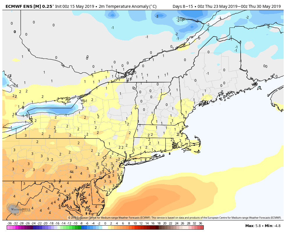
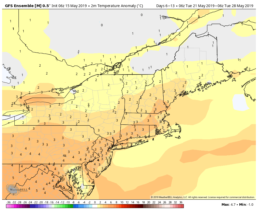
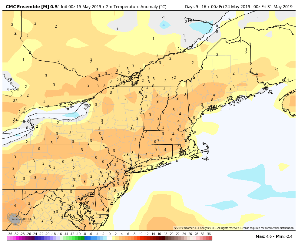
The overall theme for the last week of May is relatively dry and possibly on the warm side. Most computer models are projecting a summer preview in late May. That’s nothing new for these parts, but I’m a little hesitant to completely buy into the warmth given the way this spring has gone. At a minimum, I think the temperature will be close to normal – which is pretty nice in late May!