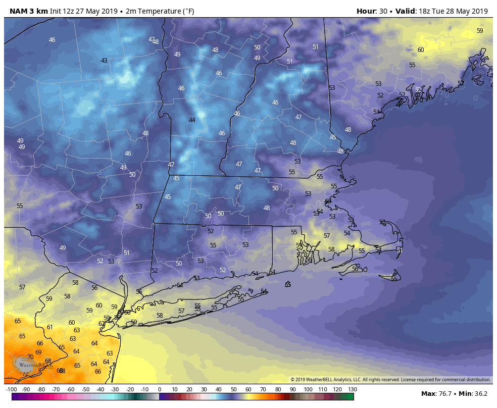
The Memorial Day weekend featured some outstanding weather. There was an early-summer feel with plenty of sunshine. Unfortunately, we will get a reminder in the midweek that late May can occasionally be cool and unsettled in Southern New England. A disturbance approaching from the west will bring showers from west to east across Connecticut, Rhode Island and Southeastern Massachusetts on Tuesday. The weather will likely stay dry through midday with temperatures reaching the low 60s before showers arrive. When the rain begins, look for the temperature to fall into the 50s. The best chance of rain is after 2 pm.
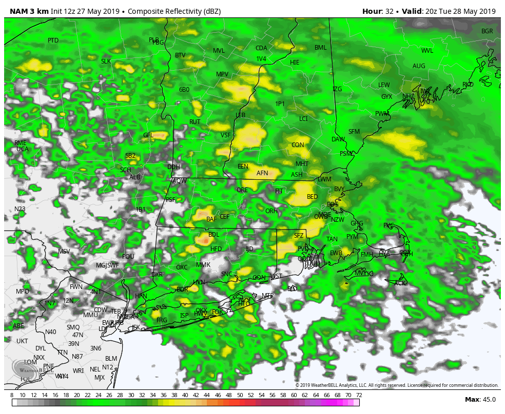
Showers continue through the late afternoon and into the evening. There is a lower chance of rain after midnight, but it will stay cool and cloudy into Wednesday. Heavier downpours with thunder are possible late in the day into the evening. It looks like most towns will get at least 0.25″ of rain, but some could get more than an inch of rain in localized downpours. The highest likelihood of heavier downpours is over CT.
Wednesday’s temperature forecast is tricky because of the uncertainty about how much cloud cover there will be over Southern New England. There’s a reasonable chance that the clouds break over CT and the temperature will spike into the low 70s. There’s a lower chance of that happening over eastern Massachusetts, and it may stay in the 50s with an onshore breeze. Rhode Island may eventually nudge up into the 60s as the clouds thin in the afternoon. We have reached the point in the year where “if it’s not bad, it’s good” weather-wise. All it takes is a break in the clouds to get the temperature near 70.
Thursday looks ok, and may get to 80 with enough sunshine, before a cold front swings through with showers and thunderstorms late Thursday into early Friday. It’s early, but the weather looks fine Friday and Saturday. It will be breezy on Friday as the front moves offshore. Saturday may be a delightful early-June day with temps in the 70s followed by an afternoon sea breeze. TA nearby front could trigger a few showers on Sunday, but it’s far too early to get very specific about that forecast.


