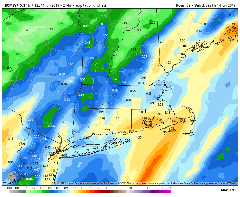
June 11 – Rain returns Thursday; Mid-weekend showers possible
The forecast has been remarkably consistent for the past week. It was around the middle of last week that we started talking about rain Monday night into Tuesday and again on Thursday of this week. The first system delivered on its promise of heavy downpours with more than 2″ of rain in part of RI and E MA, and lower totals in CT. The next storm system coming through on Thursday will also feature heavy downpours.
In the meantime, expect a nice and comfortable Tuesday night before a sunny Wednesday. It looks like a beautiful day with highs in the 70s and comfortable humidity. There will be an afternoon sea breeze.
The weather stays dry through Wednesday night before a fast-moving storm system brings a slug of rain on Thursday. Showers may arrive before 7 am in southwest CT, and likely move through eastern CT, RI and E MA by 9-10 am. The heaviest downpours are likely from late morning through mid-afternoon, with rain winding down by 3-5 pm from southwest to northeast throughout Southern New England.

A disturbance swinging through on Friday could lead to an isolated shower, but for the most part it looks dry. It will not be extremely warm, with highs in the 70s. The weekend forecast is tricky. Right now, it looks like Saturday will be a fine day with highs in the 70s to low 80s (warmest inland). There will be a front to the west of New England by mid-weekend, and it’s unclear if it will move close enough to bring a round of showers/storms on Father’s Day. Right now, it looks like the best chance of any rain is in the morning. It’s a forecast that I will be watching closely.
Also, there are signs that the first extended stretch of warm/humid weather is in the cards for early next week. Highs may be in the 80s for a few days with lows in the 60s. This weekend is a good time to get the A/C units in the windows.


