A series of disturbances riding along a stalled boundary near New England will bring rain chances over the last few days of spring. The summer solstice is Friday at 11:54 a.m. EDT, and it will likely arrive with unsettled weather on the first day of the season. The good news is the front will move away by the weekend and most or all of the first summer weekend looks pretty good.
Scattered showers are possible late Monday night over CT, RI and SE MA. There may be a lull Tuesday morning before showers return midday into the afternoon. The best chance of steady rain is closer to the coast, with the possibility of heavy rain in some towns. It’s a close call between the heavy downpours moving into CT and Southern RI or staying offshore. Highs will be near 70 on Tuesday, but it will be muggy.

There is a lower, but not zero, risk of showers on Wednesday. Do not expect full sunshine, and it will be slightly cool for this time of the year with highs in the low 70s. There will be noticeable humidity through midday then it turns less muggy by the evening.
Right now, it looks like Thursday will be mainly dry. There is an increasing chance of rain Thursday night through midday Friday. Once again, heavy downpours are possible, but not guaranteed. That’s just the way it goes in the summertime with these types of weather systems. Highs will be in the 70s Thursday and may not get out of the 60s on Friday.
Saturday looks dry, breezy, and much less humid. The wind may gust over 25 mph, but there should be some sun with highs well into the 70s. I’m not convinced it will stay dry through the weekend. A few showers could drift into at least western New England sometime between late Saturday night and Sunday night. If that disturbance stays west or slides to far south, then the good times roll on with temperatures in the 70s to near 80 on Sunday.
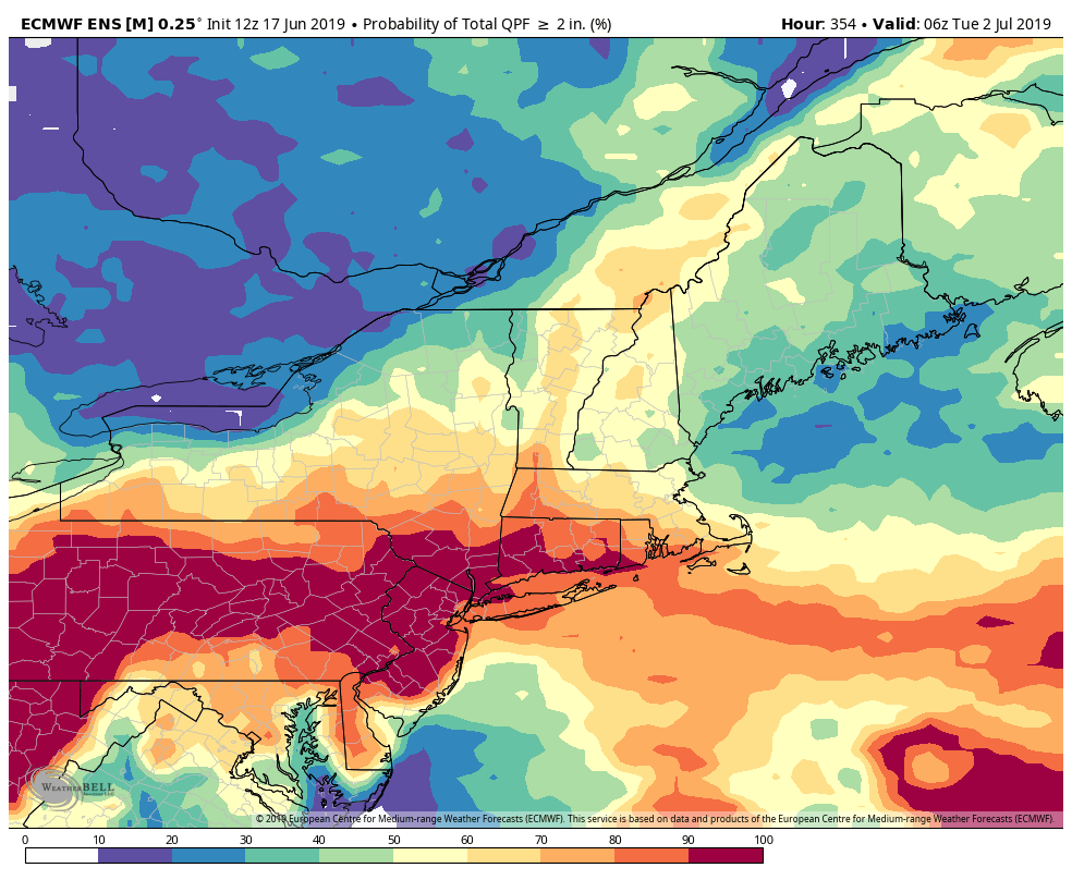
The overall pattern favors above normal rainfall for the rest of the month. The EPS ensemble has a high likelihood of at least 2″ in the next two weeks in Southern Connecticut. Water restrictions are not likely anytime soon!