The switch has been flipped and it feels like summer in Southern New England. The warm and muggy weather continues with a nice Friday afternoon. Highs will not be far from 90 inland, and it will be closer to 80 at the beach. A disturbance approaching from the west threatens Southern New England with showers and thunderstorms on Saturday. It looks like most of the action will be in the late afternoon into the evening and away from the coast, except for southwest CT. It will be very humid with highs in the 80s on Saturday.


Another disturbance passing through on Sunday will trigger another round of showers and thunderstorms. There is a decent chance that everyone in CT, RI, and SE MA will see at least one shower/storm between Saturday afternoon and Sunday evening. The storms that move through this weekend could produce strong winds, frequent lightning, and torrential downpours.
4th of July week
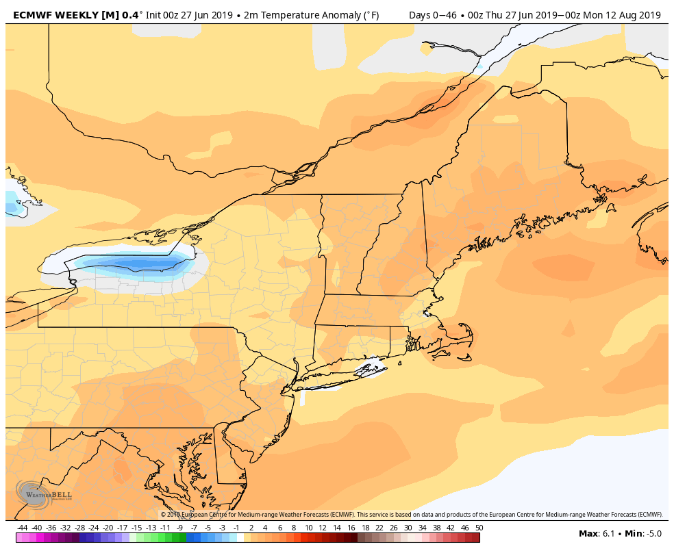
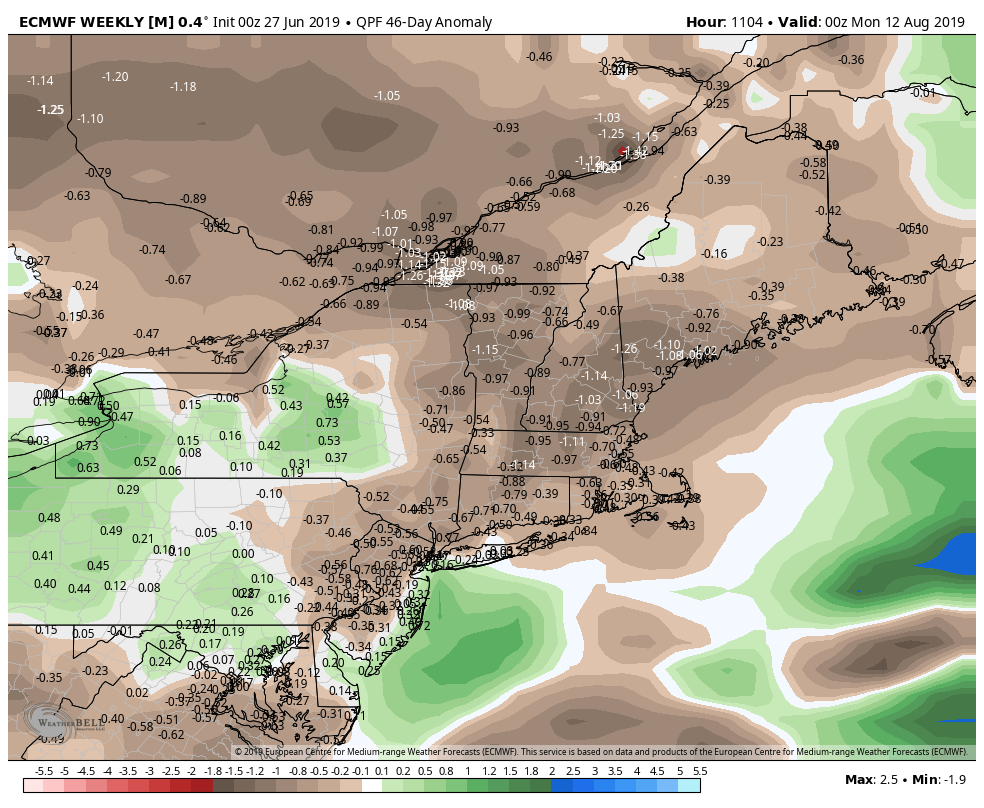
The weather pattern looks warm and humid for the first week of July. It is too early to determine if there will be afternoon thunderstorms, but it should be dry most of the time. Highs may get close to 90 inland for a couple of days, with the 4th potentially one of those days. Lows will be in the 60s. It will be a bit warmer than normal for early July, and it looks like that trend may continue through the month. The latest European model outlook calls for a relatively warm stretch of weather in July. It also predicts below normal rain, which is a change from what I have seen in the past few months.