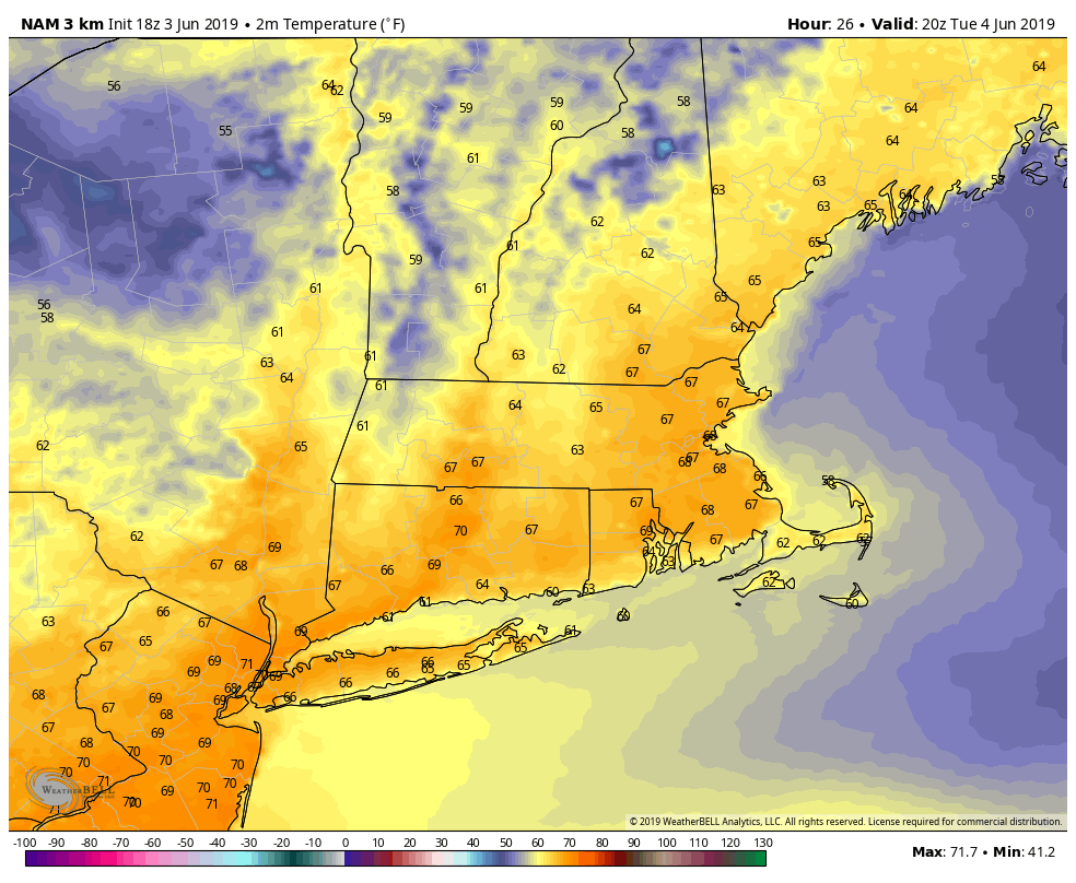
Bright, sunny and slightly cool weather continues on Tuesday in Southern New England. The humidity will stay low and the wind will be a bit lighter than it was on Monday – especially in the morning. Look for high temperatures near 70 degrees, with a sea breeze cooling the coast in the afternoon. Sunshine should be abundant through most of the day.
The weather turns somewhat unsettled in the mid to late workweek as a series of disturbances move in from the west. A few showers possible on Wednesday. Most of the day looks dry, with the best chance of rain late in the day in the western half of Connecticut. Highs will be near 70 again, but it will be more humid than Tuesday.
Stray showers are possible Wednesday night and during the day on Thursday. It will be humid with highs in the low to mid 70s. Pop-up showers cannot be ruled out over RI and SE MA on Friday with highs in the 70s again.
It’s early, but the outlook for the weekend is decent. Right now, Saturday look better than Sunday with sunshine and highs in the mid to upper 70s. There may be more clouds and a cooler breeze developing late Sunday as a backdoor front slides down the New England coast. At this point, it still looks like a pretty good day with highs in the 70s.
Cooler in mid-June
The early outlook for mid-June is for cooler than normal and possibly unsettled weather. Early next week there will likely be a battle between a storm system to our south and a strong high pressure system over eastern Canada. The temperature may not make it out of the 60s between Monday and Wednesday of next week. If the storm drifts far enough north, then clouds/showers get into the mix. If it stays south, expect fair skies, just a bit cool for mid-June. My feeling is that the storm will stay to our south for a couple of days early next week before drifting north and bringing some rain.
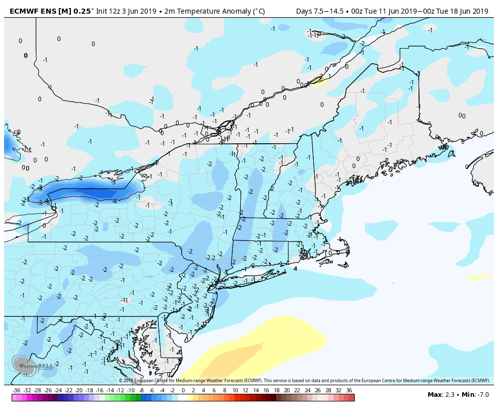
The same general pattern may hold through most of next week, with long-range computer models predicting temperatures about 3-4 degrees cooler than normal on average. It’s highly unlikely that the temperature will get close to 90 degrees through Father’s Day weekend. It’s not typical to get hot weather in early to mid June, but it happens from time to time, and after an unsettled spring some are anxious for summer-like heat. It looks like you’ll have to wait a bit for the hazy, hot, humid days.


