The temperature reached the 90s inland and mid 80s at the coast on Wednesday, and that’s the kind of weather we’ll have to get used to as we head through mid-July. Thursday does not look quite as nice or as warm because of clouds rolling through ahead of very muggy weather. Look for highs in the 80s with a southerly wind, and a brief, passing shower cannot be ruled out. Expect the temperature to fall to near 70 degrees Thursday night as it stays humid with scattered showers and thunderstorms rolling through.

The scattered storm threat continues with high humidity on Friday. It will not be a washout, and the best chance of rain seems to be very early in the day and then again in the mid to late afternoon. Highs will be in the 80s as it stays muggy. So, where is all the very warm weather? It arrives this weekend and stays through most or all of next week.
Look for a nice weekend with a decent dose of very warm July sunshine both Saturday and Sunday. It will flirt with 90 inland, and be in the 80s at the coast. There will be noticeable humidity, so the air conditioners are unlikely to get a break. Fine weather continues early next week with highs int the 80s Monday and Tuesday.
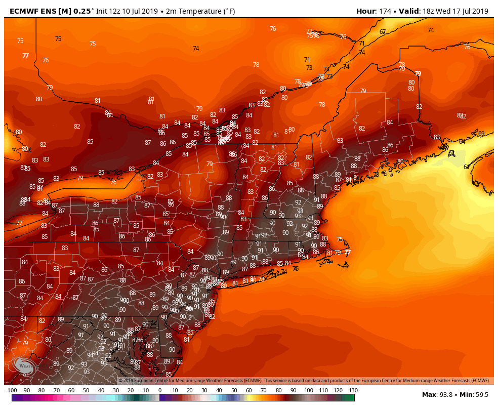
It gets hotter and even more humid in the mid to late workweek. It’s early, but there is a good chance of 90°+ on Wednesday. The high temperature on Thursday and Friday will be contingent on cloud cover, but more 90° heat is possible. Lows may be in the 70s for a few days late next week.
Barry likely to form in Gulf of Mexico
Tropical Storm Barry is on the verge of forming in the Gulf of Mexico. The storm may strengthen to a hurricane before making landfall in the Bayou. Right now, it looks like landfall will happen Saturday morning in the western half of Louisiana. There will be rain and gusty wind in New Orleans, but the Big Easy could be spared the worst of it. A northerly wind at the start of the storm will blow water across Lake Ponchartrain and test the levees that protect the city. The storm is not expected to be ferocious enough to inundate the city. Baton Rouge has a better chance of strong winds and torrential rain. That part of Louisiana could see more than a foot of rain.
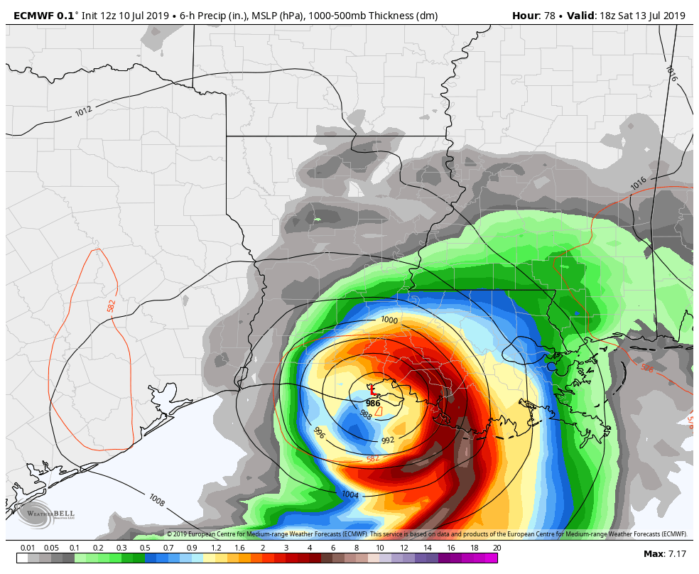
What’s left of Barry will move into the central United States and gradually weaken. The winds will come down pretty quickly, but it may take a while for the storm to rain itself out. Thankfully, it looks like the storm will continue moving inland and not lead to the historic rain totals that Harvey brought. Late next week, the remnants of the storm could get caught in the jet stream and bring showers to part of New England. That’s a long way down the road for a storm that has not officially formed yet, and I will be tracking it.


