July 8 – Hot and dry in mid-July
The first week of July was relatively warm and dry in Southern New England. It looks like that pattern will continue through the middle of this month. The week begins without terribly muggy weather and oppressive humidity should stay away through the midweek even though it will be getting warmer. You’ll notice some humidity (it is July after all), but it will not be as thick as it was on Saturday. Look for temperatures to climb through the 80s over the next few days, and it may be close to 90 inland on Wednesday afternoon.

There will not be any rain through Thursday afternoon. A frontal system approaching late in the workweek brings scattered thunderstorms Thursday night and Friday. It looks like a typical summer cold front with the potential for locally heavy rain, but also the possibility that some areas do not get much at all. Friday will likely not be a washout.
The weekend outlook is for seasonably warm to hot weather and a slight shower/storm threat on Sunday. Very warm to hot weather is in the forecast for the early to middle part of next week with a strong Bermuda high pressure system controlling the weather.

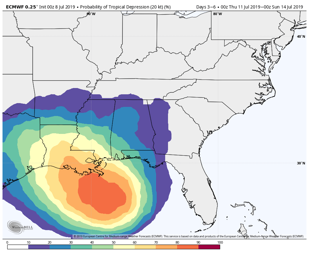
There is a good chance that a tropical depression develops in the Gulf of Mexico this week. It will likely make landfall as a tropical depression or storm somewhere along the Texas or Louisiana coast late in the workweek or early this weekend. The long-range forecast keeps the remnants of the storm in the central United States with no impact in New England.

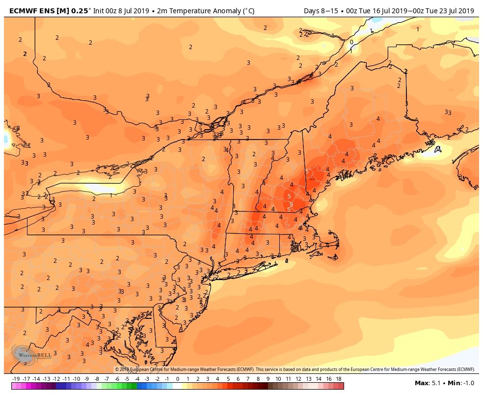
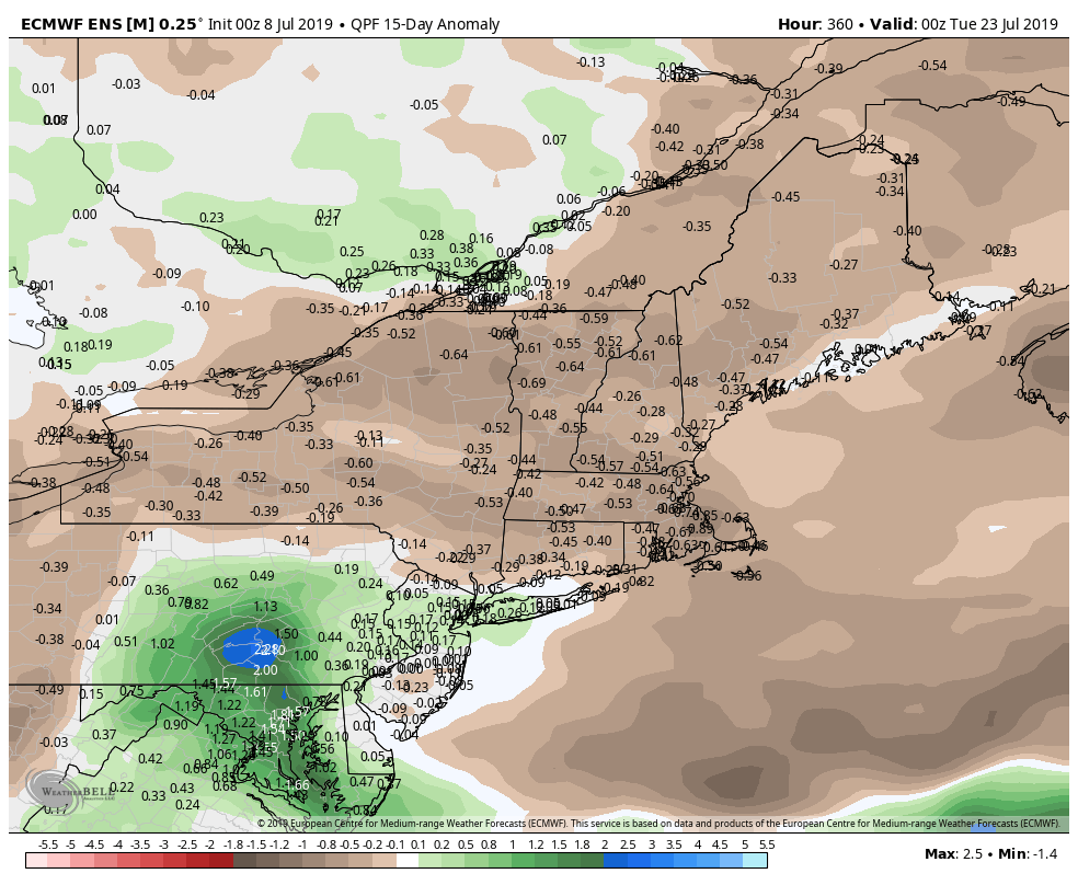
Looking ahead through mid-July, there is a good chance that it stays relatively warm in the Northeast. It’s tough to say if it will be very hot with highs in the mid 90s or just seasonably warm with highs in the upper 80s. Those details will be worked out in the next week or so. It also looks relatively dry over the next couple of weeks. It will be interesting to see if the lush green lawns dry out very quickly with the warm/dry weather.


