July 2019 was one of warmest months on record in Southern New England. There were plenty of 90 degree days, and the persistent high humidity prevented the temperature from falling much at night. It was one of those months where the electric bill could be shocking when it arrives in August.
Here’s a look at the all-time monthly rankings for July 2019 average temperature
Bridgeport – 3rd warmest since 1948
Hartford – Warmest since 1905
Boston – Warmest since 1872
Providence – 3rd warmest since 1905
Worcester – 9th warmest since 1892
We are past the historically warmest part of the year, and the lowering sun angle combined with shorter daylight means that the normal high/low temperature falls by about 4 degrees in August.
The first week of August looks warmer than normal, but not as hot as most of July was. There is a lower chance of seeing 90 degree weather in the first two weeks of this month. The dog days of summer continue for a couple of weeks, and that means the a/c will be running as the temperature likely stays in the 60s to low 70s at night through mid-August.
It also looks like it will be relatively dry for the first weeks of the month. In the next five days, the best chance of rain is Saturday. Expect scattered showers and thunderstorms, more so in CT than RI or E MA.
August also means it’s time to keep a close eye on the tropics. There are a couple of disturbances in the Atlantic, and one heading for the Caribbean islands or just to the north will likely become at least a tropical depression in the next few days. The long range outlook keeps the storm well off the Eastern Seaboard, but it’s still very early in the forecast cycle.
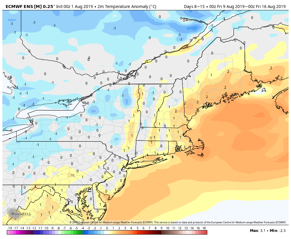
EPS mid-August temp anomaly – slightly warmer than normal 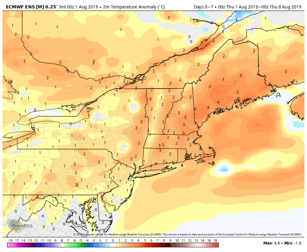
EPS one week temp anomaly – warm 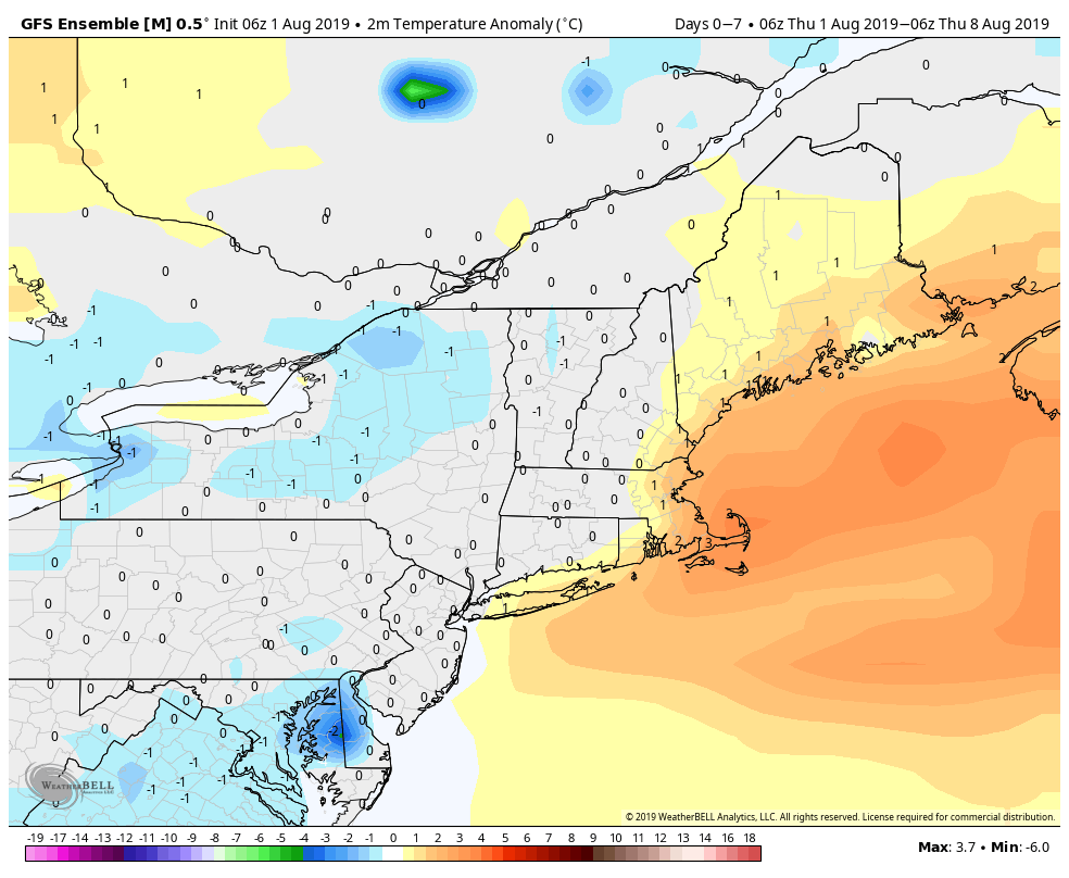
GEFS one week temp anomaly – slightly warmer than normal 
GEFS mid-August temp anomaly – cooler air arriving 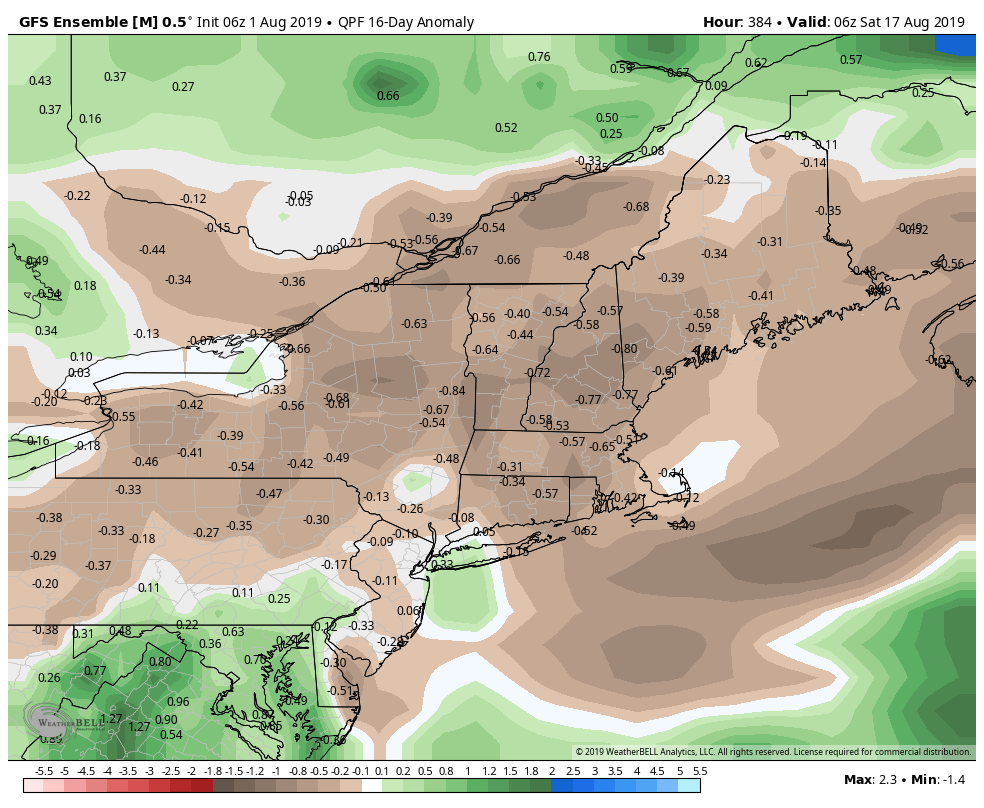
GEFS – Relatively dry in the first half of August 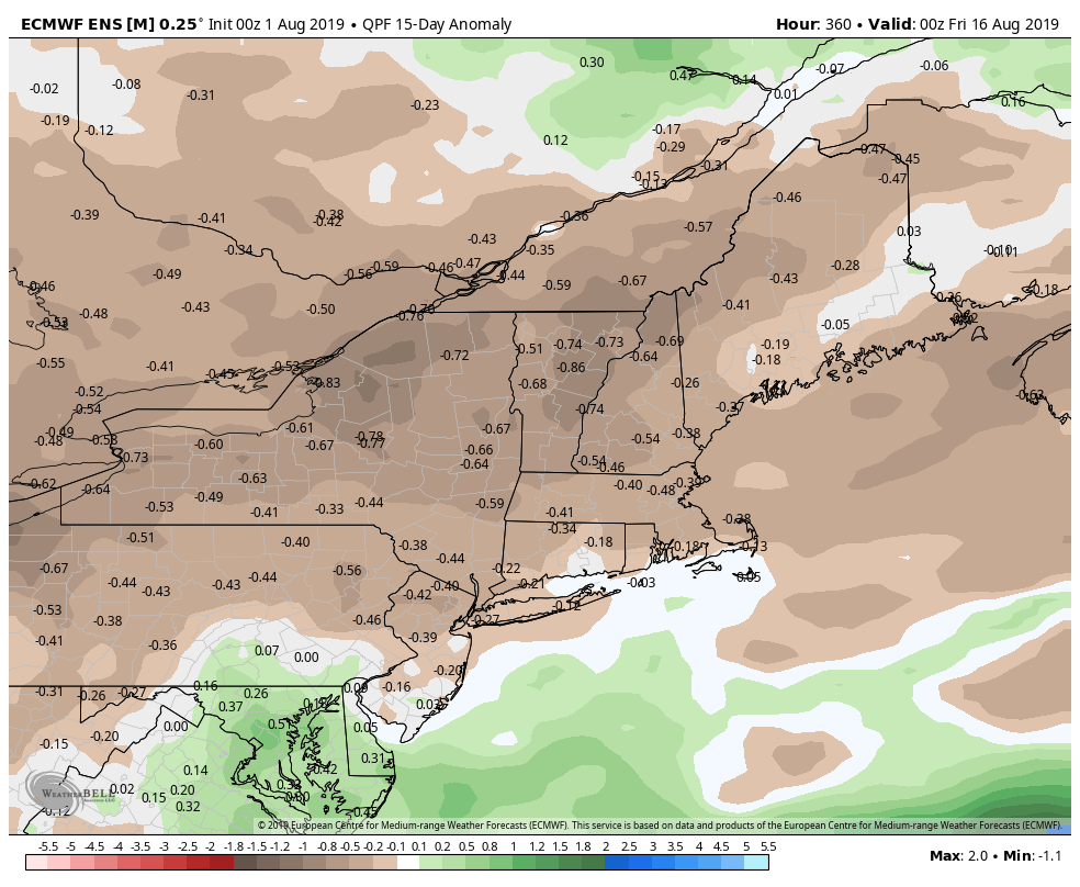
EPS – Relatively dry in the first half of August 
GEFS tracks are farther south than the EPS and Canadian models 
Canadian ensemble members also keep any storm offshore 
Tropical models for Invest 96L – a west-northwest track 
EPS odds of tropical cyclone formation (moderate-high) 
Tropical models for Invest 96L – a west-northwest track 
EPS members show any storm that forms staying offshore


