This morning was the coolest since mid-June in Southern New England. It was the first day below 60 in Boston and first below 55 in Providence since June 14 – more than ten weeks ago! The refreshing fall preview continues with fine weather early this week. Expect highs in the low-mid 70s on Monday. Lows will be in the 40s/50s again Monday night. It may be even cooler than Sunday night was.

Expect the temperature to bounce back into the low to mid 70s again on Tuesday with a decent dose of sunshine early followed by clouds in the afternoon. The weather will stay mainly dry through the day on Wednesday. It will not be as cool Wednesday morning, but wills till be comfortable in the 50s to near 60 at dawn. Look for highs in the mid 70s to low 80s on Wednesday afternoon depending on cloud cover.

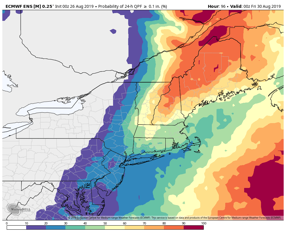
A disturbance off the Southeastern US coast will move north over the next couple of days and will interact with a cold front moving through New England Wednesday night into Thursday. Right now, it looks like nothing more than a chance of showers in that time frame. If the offshore system is drawn a little closer to New England, those showers could be enhanced. At this point, there’s not a very high likelihood of more than 0.1″ of rain in most towns. That’s not much!
The shower threat will likely diminish pretty quickly on Thursday, and it will be a seasonably warm day with highs in the low-mid 80s. A westerly wind will keep the humidity low. IF the front clears through early in the day, it could be a real beauty and an awesome late-August beach day. We will head into the Labor Day weekend with relatively warm weather continuing Friday and Saturday. Humidity will increase by Saturday.
It does not look like the warm and rain-free weather will last through the whole Labor Day weekend. There is a still a long way to go, but the odds favor a disturbance coming through the area sometime between Sunday and Monday. The temperature will likely settle back into the 70s, and showers are possible either Sunday or Monday. We’ll fine-tune this forecast as the week progresses.

Tropical Storm Dorian is better organized this morning with winds up to 60 mph. It may become a hurricane in the southern Caribbean as it gets closer to Puerto Rico and the Dominican Republic in the middle of this week.
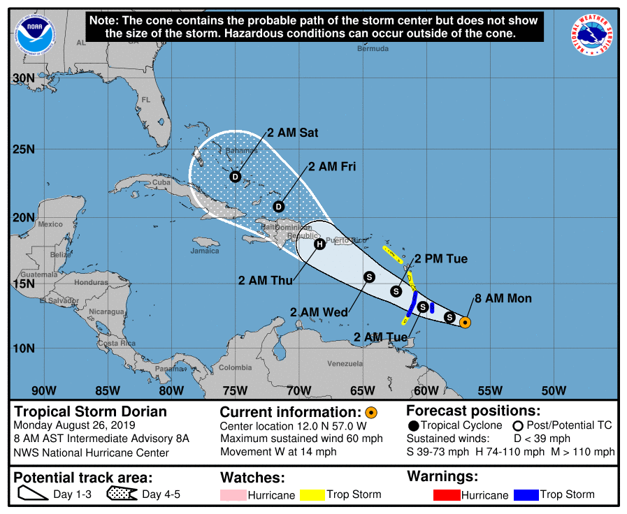
The question is what happens to Dorian as it passes Hispaniola and moves into the Bahamas. The environment will not be as favorable for tropical systems and the storm should weaken. If it does not completely fall apart, it could strengthen again as it nears the Southeastern United States early next week. That is a long way down the road for a storm that is still so far from the United States, but I think folks in Florida, Georgia and the Carolinas should check in on the long-range forecasts for Dorian this week.


