The Labor Day weekend begins with great weather and ends with a few showers in Southern New England. Saturday will be the warmest day of the weekend with highs in the mid 70s at the beach and low 80s inland under mostly sunny skies. There will be a few more clouds and a cooler breeze on Sunday. That keeps the temperature in the upper 70s inland and low 70s at the coast. A disturbance moving through on Monday brings an increasing threat of showers/thunderstorms – especially for inland areas. There will probably not be a lot of sunshine, but the temperature will be in the mid-upper 70s with a muggy feel.
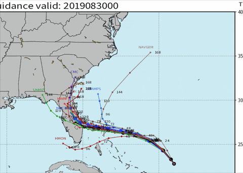
The shower threat ends Tuesday morning and dry weather is ahead for Tuesday afternoon. Another front approaching from the west on Wednesday could trigger a few showers mainly in the afternoon or at night. It does not look like a very wet system. Dry weather is likely for Thursday and Friday. After that, the forecast is uncertain because we do not know where Dorian will go. It’s not out of the realm of possibility that Dorian comes close enough to New England to bring some wind/rain.

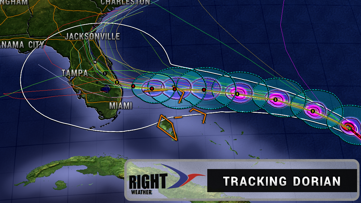
The forecast for Florida is not quite as uncertain and residents there are preparing for an impact from the storm. It’s not known exactly where the storm will strike and if the eye will make landfall, but the storm is strong enough and will come close enough to pose a significant threat that requires action.
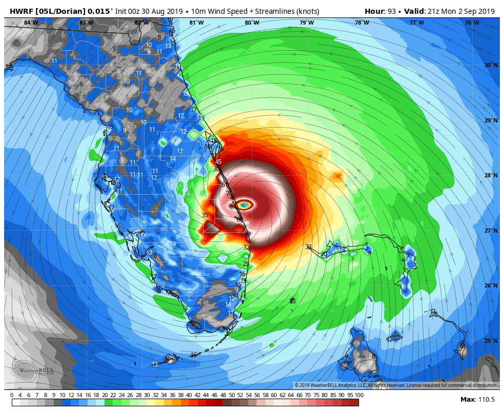
The National Hurricane Center forecast is for a Category 4 hurricane moving through the northern Bahamas and approaching Florida most likely somewhere between Fort Lauderdale and Cape Canaveral in the Monday night – Tuesday time frame.

Hurricane track forecasting is much more accurate than hurricane intensity forecasting. Having said that, conditions are favorable for strengthening in the next 2-3 days. However, it would not surprise me if Dorian was a Cat 2, 3 or 4 hurricane when it approaches the Florida coast. If the storm is going to make it into the Gulf of Mexico, then a due west track is likely this weekend.

The upper-level wind pattern favors a turn to the north and then northeast, but it’s uncertain when the turn will happen. A best-case scenario has the storm turning before the eye reaches the Florida coast. A hard turn to the north and northeast could keep the storm offshore of the Southeastern US completely. This is not the most likely scenario, but it’s still possible.
Dorian in Southern New England?
As mentioned earlier, Dorian’s long-range track is quite uncertain. There is a low chance that the storm turns north and then races along the Eastern Seaboard coming close enough to New England for wind/rain. This is not the most likely scenario, and it’s nothing to get too worked up about a week in advance. A more likely scenario is a turn to the east that keeps the storm southeast of our area without much impact. I should have a better idea about Dorian’s track by the end of the Labor Day weekend.

Elsewhere, the tropics are pretty quiet. There’s a tropical wave coming off the African coast that could become a tropical system in 3-4 days. The outlook for it is a turn to the north into the open Atlantic. The climatalogical peak of hurricane season is about a week away.


