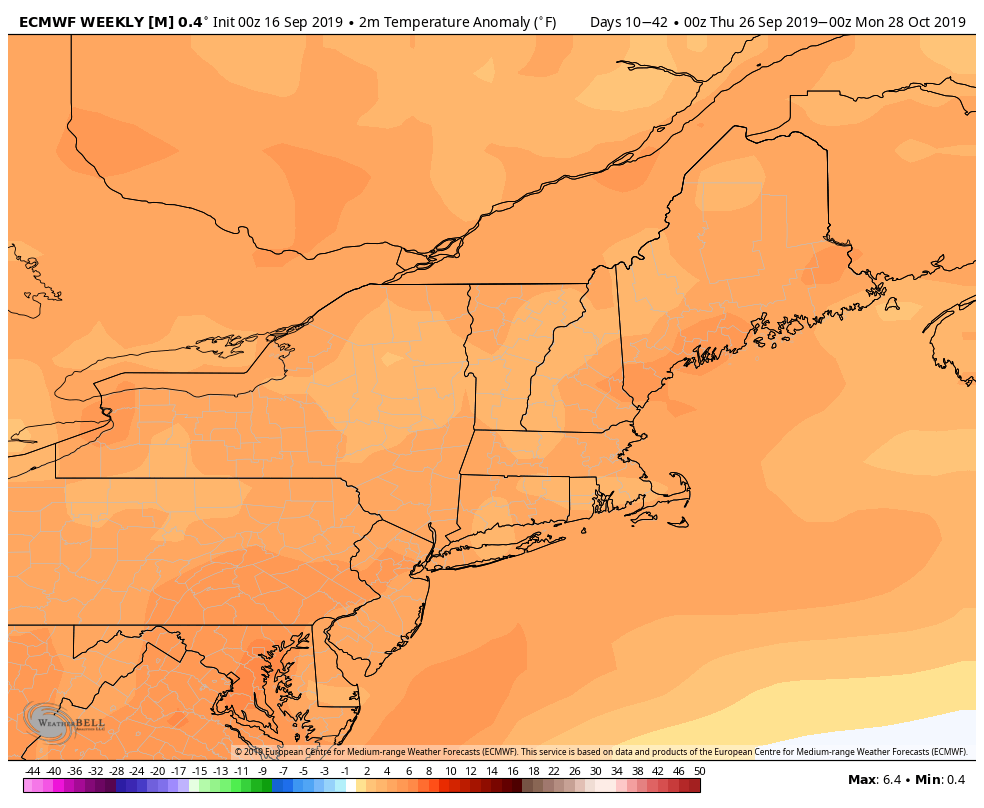
Do not be fooled by a couple of chilly mornings late in the workweek. We are heading for much warmer weather during the upcoming last weekend of summer. Fall begins early Monday, but it will feel more like late August this weekend into early next week. The relatively warm weather pattern may persist through the end of September.
A cool northeast breeze is bringing a fall feel for Wednesday afternoon through Friday morning. Expect highs in the low 60s on Wednesday with the breeze gusting to 15-25 mph under partly sunny skies. It will be chilly Wednesday night. The temperature will dip into the low to mid 40s in most towns, with a few areas getting into the upper 30s! Thursday also looks cool, with highs in the mid 60s and a lot of sunshine. It will not be as windy as Wednesday. Look for another cool night Thursday night.
The warm-up begins on Friday, with temps soaring into the mid 70s to near 80 during the afternoon. Keep the window A/C units in because this weekend will feature highs in the low to mid 80s away from the coast. It will be in the 70s at the beach. The low temperature may not get below 60 degrees, which is rather warm for late September.
Relatively warm weather continues into next week, and the same general theme will likely persist through the end of the month and possibly longer. The normal high temperature dips below 70 by the end of September, but there are signs that most or all of the days near the end of this month will feature highs in the 70s.
Active weather in the tropics
Hurricane Humberto will give Bermuda a glancing blow as it passes northwest of the island. Tropical storm conditions are likely, but they should be spared hurricane-force winds. The storm will continue moving northeast into the North Atlantic without making a landfall. Swells and rough surf are likely for the Atlantic Seaboard.
Tropical Storm Imelda came and went pretty quickly yesterday as it brought squally heavy rain to the coast of Texas. Houston and surrounding areas are getting several inches of rain from the storm that has weakened to a tropical depression upon moving inland.
Tropical Storm Jerry is nearly 1000 miles east of the Caribbean Islands and will likely head just north of the Caribbean as it strengthens into a hurricane. The long-range track for Jerry is not certain, but it looks like it will curve out to sea. There is still a chance that it takes a more southern track towards the Southeastern United States.


