Fall is here, but it sure does not feel like it! The dew point is in the mid 60s to near 70, and the temperature will soar into the mid-upper 80s inland Monday afternoon. A gusty southwest breeze will keep it cooler near the coast. The normal high temperature is near 70, so this is VERY warm for late-September. However, it’s not likely to challenge the record highs for the date. The record highs for September 23 are in the low to mid 90s.
The muggy weather will be swept away by a cold front that passes by Monday night. Scattered showers and thunderstorms are likely between sunset and sunrise. Most towns will get 0.25″ or less rain. That’s not great news as September has been very dry in most of Southern New England.

Tuesday will feature some clouds, and a stray shower cannot be ruled out, but it looks mainly dry. Expect highs in the 70s with lower humidity. The temperature will dip into the 50s Tuesday night under clear skies. Wednesday will be a nice day with sunshine and highs in the 70s. It will get warmer on Thursday ahead of another cold front. It may reach 80 again inland with a southwest breeze. Scattered showers/storms are possible late Thursday afternoon as the front passes.
The outlook for Friday and the weekend is for more relatively warm weather. Highs will be in the 70s Friday, and it could be in the 80s inland again this weekend. A front will approach Sunday afternoon, and that will bring some clouds.
Warm start to October
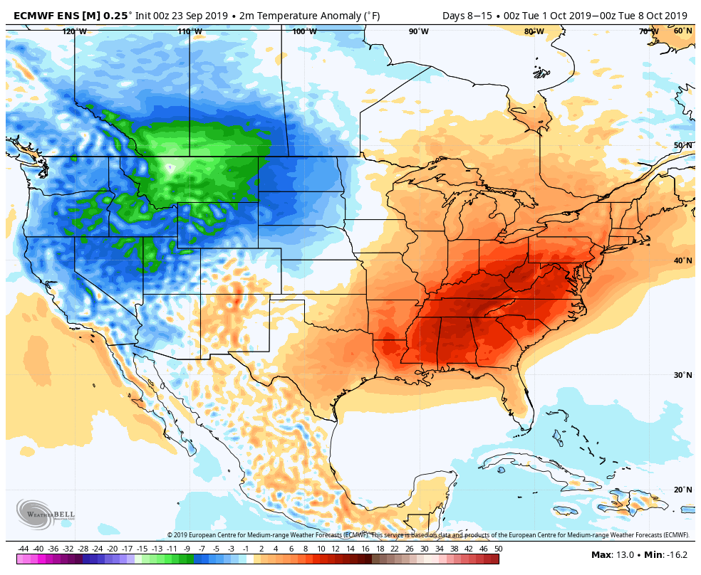
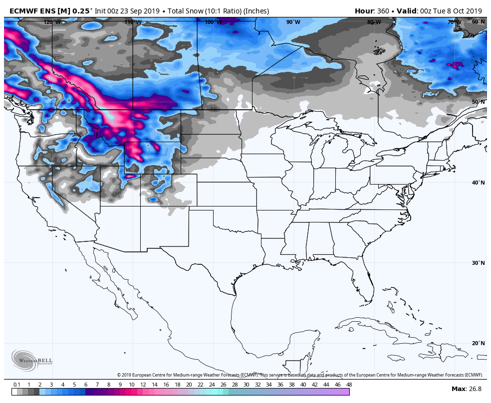
There is a good chance that the weather will stay relatively warm in the Eastern United States in early October. While it’s warm in the East, it will be cold in the west – particularly in the northern Rockies. They will be seeing snow while New England enjoys well above normal temperatures.
Where will Karen go?
That’s a good question! It does not look like Tropical Storm Karen will strengthen much as it moves north through the Caribbean this week. Puerto Rico will be hit by the tropical storm in the midweek. It will continue moving due north until late in the workweek when it will likely either dissipate or turn west and head towards the Southeastern United States. If it survives the westward turn, conditions become favorable for strengthening as it gets closer to Florida. It’s something to watch for the Southeastern US.


