Columbus Day afternoon looks pretty nice with temps in the 60s under a blend of sun and clouds. It will turn a bit cooler on Tuesday with highs not far from 60. Expect a lot of sunshine on Tuesday. A potent storm system arrives late Wednesday into early Thursday with a slug of moderate to heavy rain followed by gusty wind.

Scattered showers are possible during the day on Wednesday across Connecticut, with mainly or all dry weather in Rhode Island and Southeastern Massachusetts. Heavier rain arrives after sunset, and there may be some downpours with thunder around midnight. Most of the rain from the storm will fall before dawn on Thursday. The best chance of rain on Thursday is north of Southern New England.
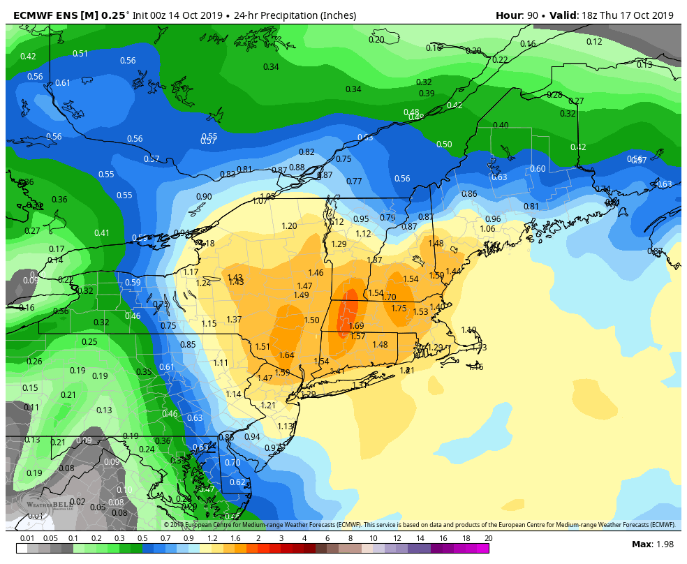
The rain does not look heavy enough for flooding, but some leaf-clogged storm drains could lead to big puddles. It will be a pretty good soaker. The back side of the storm will feature strong wind gusts on Thursday. The storm will move into the Gulf of Maine and strengthen. 35-45 mph gusts are possible, and with some leaves still on the trees, that could cause downed branches and isolated power outages. It will be cool on Thursday with temps in the 50s.
Dry weather with less wind is ahead for Friday. Expect lows in the 40s and highs near 60. Saturday morning will be chilly with patchy frost possible. Saturday afternoon looks fine with highs in the low 60s. It will likely get warmer on Sunday – into the mid and upper 60s. The overall theme for the end of August is for relatively warm weather in the Northeast. That doesn’t necessarily mean 70s, though, because the normal high temperature is only around 60.


