The cold November continues with another brief shot of very cold air coming in for this weekend. The next couple of days will feature gradually moderating temperatures, but still colder than normal for mid-November. Look for a lot of clouds on Thursday, and a few showers cannot be ruled out in Rhode Island and Southeastern Massachusetts. The temperature will start the day in the low-mid 20s before reaching the low 40s in the afternoon.
Friday should be milder, but not exactly warm. Highs will be in the upper 40s ahead of a cold front that brings back very cold weather for the start of the weekend. It will dip into the upper teens to low 20s with a breeze on Saturday morning. Expect dry skies and highs in the low-mid 30s in the afternoon. Sunday looks very cold early (low 20s) and not as bad in the afternoon. It should reach the low 40s.

The overall weather pattern is mainly dry into the middle of next week. The front coming through on Friday may bring a passing shower, but that’s about it. A storm moving off the Eastern Seaboard has a 20-30% chance of bringing some rain on Monday. Another system in the middle of next week has a better chance of delivering rain. The next shot at snow, and it’s relatively low, is at the end of next week.
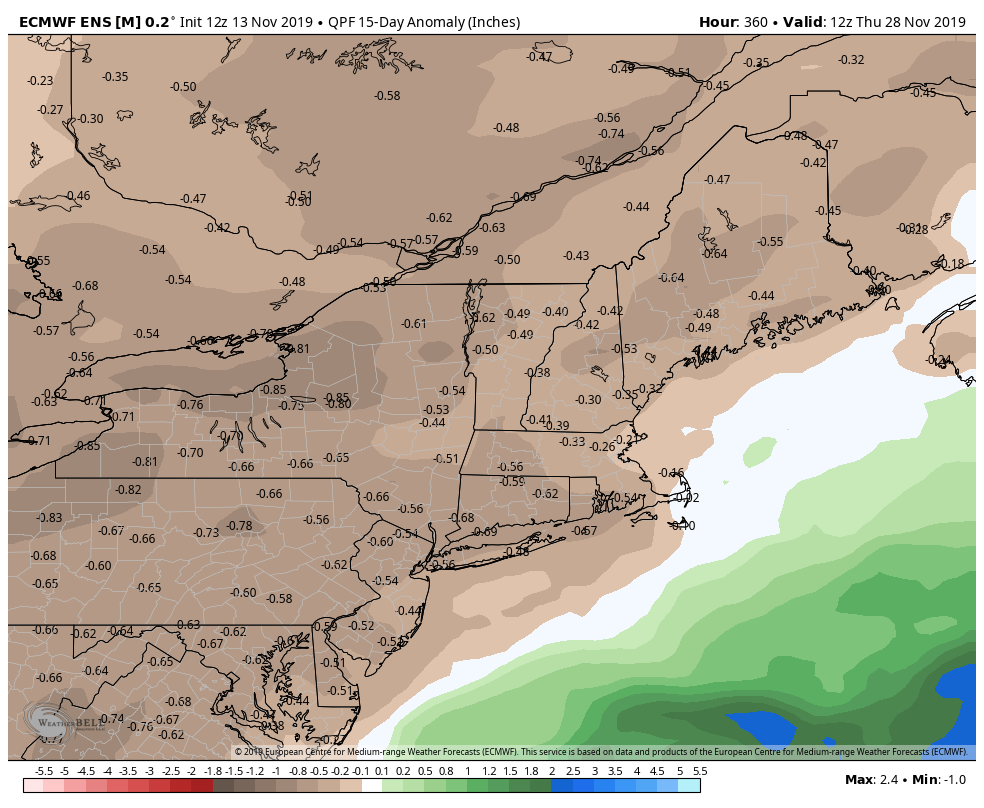
The general theme for the next 10-14 days is drier and colder than normal. The cold shot coming this weekend will likely be the coldest weather we see through at least next weekend, but there is no big warm-up on the way.