November 4 – Close call with early-season snow on Friday
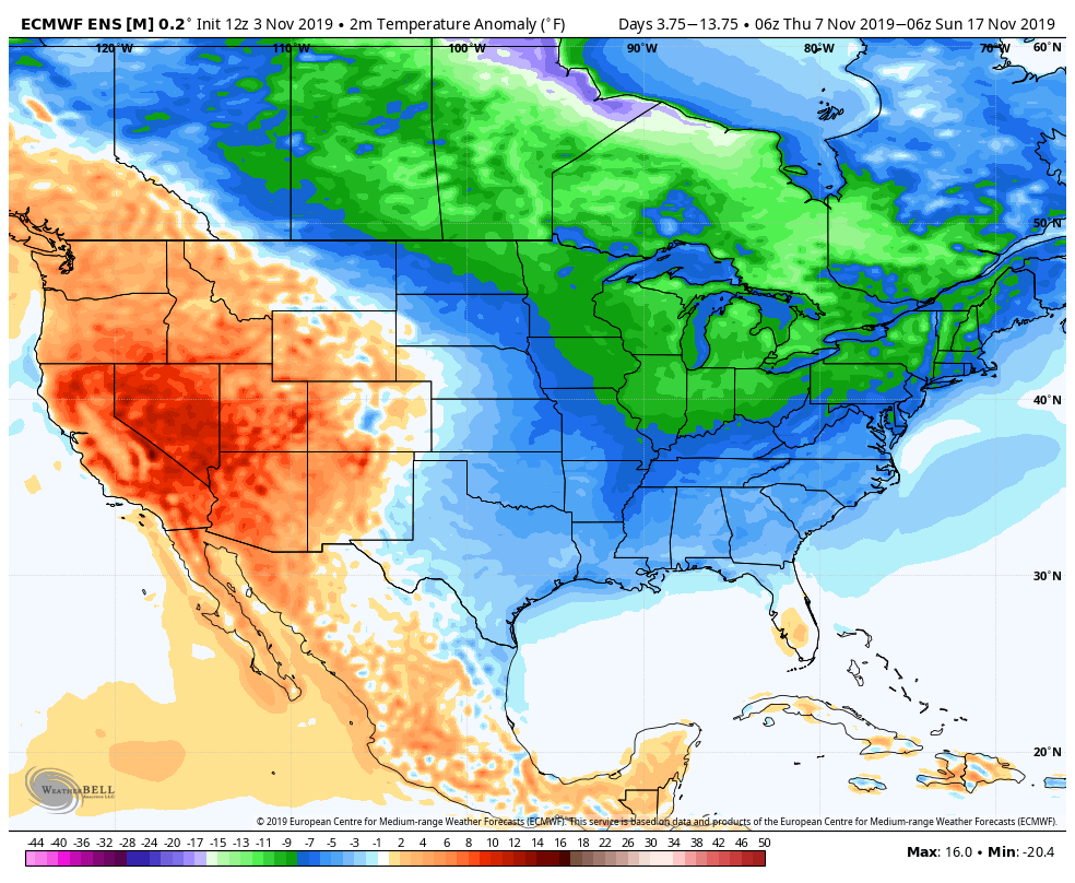
We warned you last week of chilly weather in the forecast for mid-November, and it looks very much like that will be the case for not just New England, but most of the Eastern United States. Of course, with unseasonably cold weather in November comes the threat of early-season snow. The first brush with wintry weather could be as soon as late this workweek.

The week begins with a quiet and cool Monday. Look for highs in the low 50s with a sun/cloud blend. Tuesday will be milder, but passing rain showers are possible midday and in the afternoon. Highs will be near 60. The front moves away Tuesday night and opens the door to colder weather.
Highs on Wednesday and Thursday will be near 50 again. Wednesday will feature dry skies. Clouds increase on Thursday and it likely stays dry until after sunset.
A storm system develops on a cold front moving out of the Ohio Valley Thursday night into Friday. Precipitation is likely in Southern New England, but the precipitation type is still questionable. Right now, there’s about a 15-25% chance of a snow event that causes issues on the roads and for schools. There’s about a 25-40% chance of seeing the first snow of the season, but with little impact on the roads. There’s a 60-75% chance of seeing mainly or all rain with the colder air not arriving until too late in the system.
At this point in the year 15-40% odds of seeing at least some snow are pretty high, so this bears watching as the week progresses. The higher end of the odds ranges is for inland areas, with the coast at the lower end of those ranges.

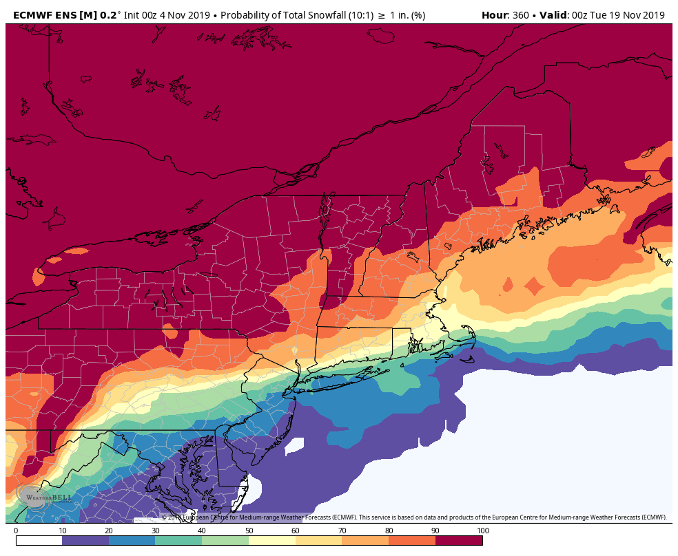
Whatever comes our way on Friday will be followed by the coldest air of the season for the weekend into next week. Expect highs in the 30s on Saturday, 40s Sunday, and then 40s at best Monday through Wednesday of next week. There may be another shot at some snow in the middle of next week, too. As you can see below, the EPS suite is predicting about a 40-70% chance of the first inch of snow coming before November 20.


