January 20 – Quiet until the weekend
Cold high pressure controls the weather scene in Southern New England for two more days before it gets a bit warmer late in the workweek. Expect lows in the teens through the midweek, but there will not be much of a breeze, so it shouldn’t feel much colder than the air temperature.
It may not get above 32 degrees on Tuesday with a blend of clouds and sun. Wednesday should reach the mid to upper 30s with mostly sunny skies. It will not be extremely cold for late January, but it’s definitely colder than what we saw earlier this month.

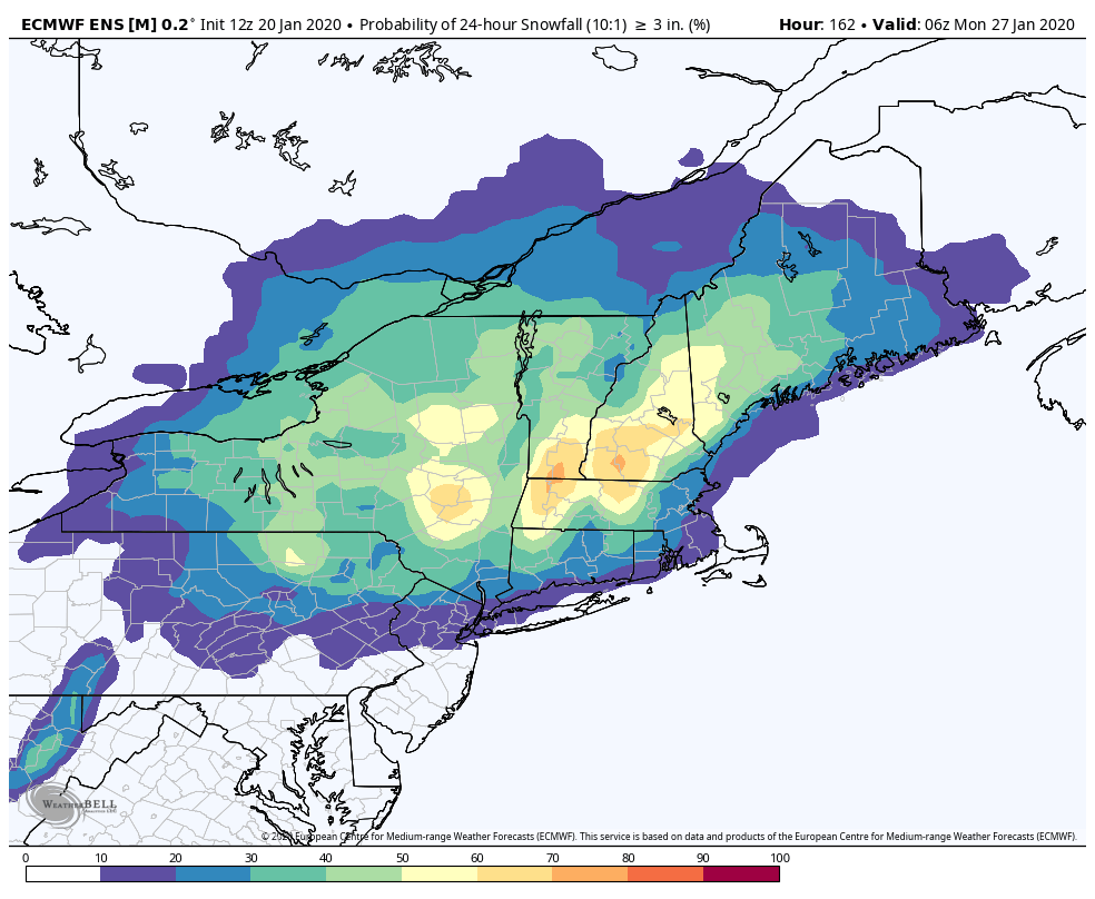
The temperature likely reaches the 40s under dry skies on Thursday and Friday. The warmer weather arrives ahead of a storm system that will bring some precipitation this weekend. It’s a bit early to say whether it will be mainly rain or wet snow. At this point, there’s about a 10-30% chance of a plowable snow in CT, RI and SE MA. The best chance of snow is inland.

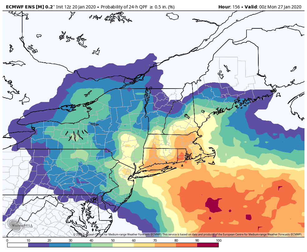
There is a greater than 60% chance of at least 0.5″ precipitation in CT, RI and SE MA between Saturday night and Sunday afternoon, and that shows that a storm is likely, but it’s unlikely to be exclusively snow.

Relatively warm pattern ahead
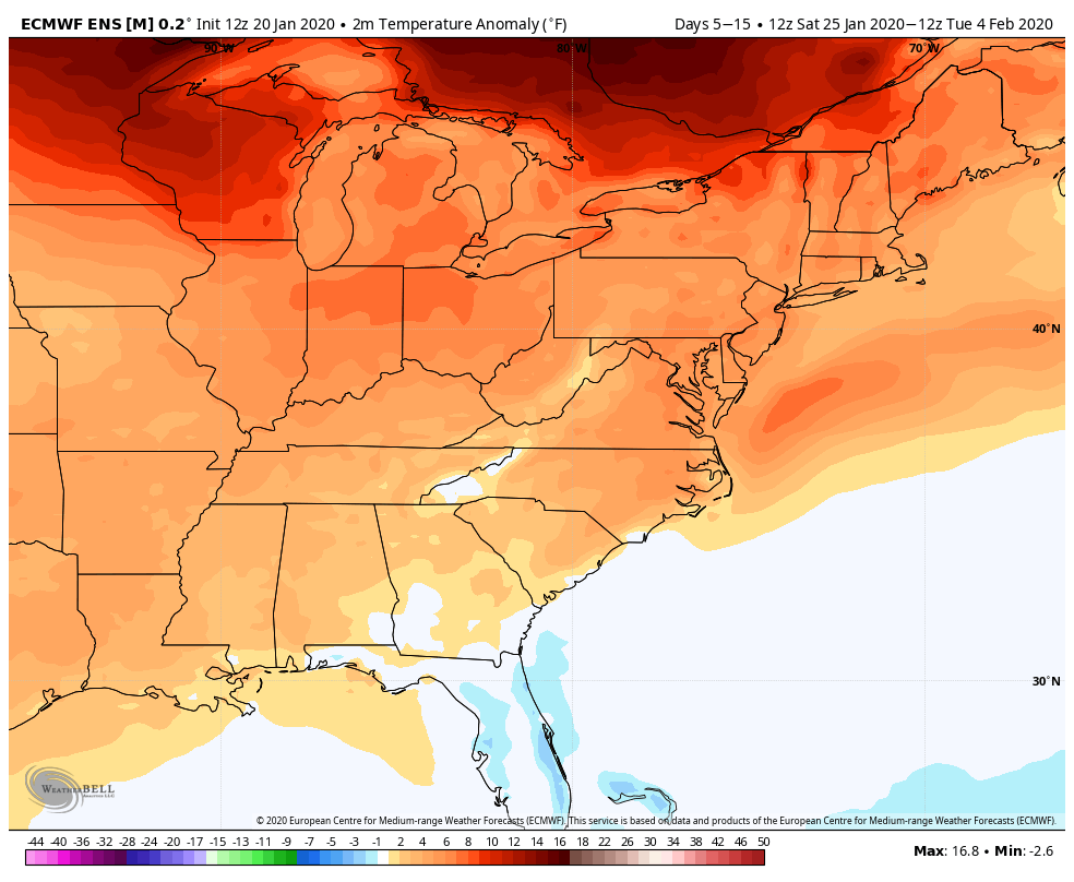
The European and American computer model suites agree on relatively warm weather in Southern New England for the last week of January and first week of February. They also show a decent chance of less snow than normal for that period.

The extended Euro model has the temperature not far from normal through February with a near-normal amount of snow. So, even if winter disappears for a couple of weeks, it may well come back by mid-February into early March.


