Punxsutawney Phil did not see his shadow and predicted an early spring. That’s what we call a persistence forecast in the biz. It means that the prevailing weather pattern will continue. I’d be a little nervous about that forecast if I was Phil.
It’s not that we’re likely to get into a deep freeze after a mild January and early February, but I think there’s a good chance that the temperature heads back to near normal later this month and into March. One of my private clients recently asked me if winter was ever going to come back. My response was that spring never comes before Valentine’s Day in Southern New England – at least not true spring. Like most years, I think we’ll see continued snow threats into mid-March.
In the near term, a warm front passing through New England Sunday evening will spread snow showers into Connecticut. The best chance of a coating-1″ of snow is away from the coast and in the western half of the state. There’s a lower chance of a coating of snow in eastern CT and RI. Patchy black ice is possible with high relative humidity overnight and the temperature near freezing.
Monday looks milder with highs in the 40s under dry skies. Light showers are possible on Tuesday with temps in the 40s again. It will turn a bit colder on Wednesday with snow and rain showers possible and highs in the 30s.

A strong storm system arrives on Thursday. There may be enough cold air around at the onset for a brief period of snow/sleet, but most of the storm looks like rain. A soaker is likely with the temperature soaring through the 40s into the 50s by Friday. It looks dry from Friday afternoon through at least Saturday. Some computer models are projecting a storm late next weekend, but there is a better chance of dry weather continuing through the weekend into early next week.
The rest of winter
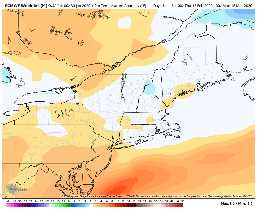
After a warm start to February, it looks like the temperature will trend closer to normal in the middle of the month. Long-range outlooks from the European computer model suite predict near-normal temperatures in Southern New England from mid-February through mid-March.
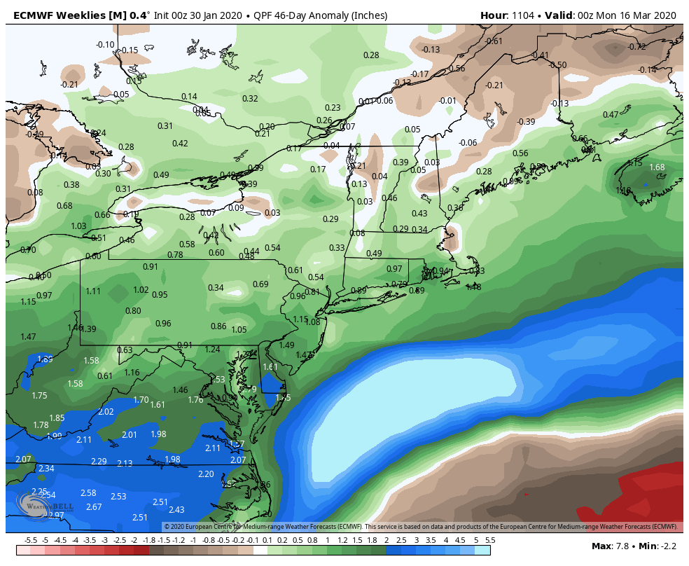
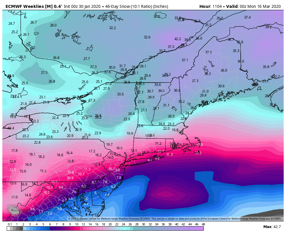
The model also predicts above normal precipitation in the eastern United States. The projected snow totals for the rest of winter are near normal in Southern New England – which means another 12-20″ of snow depending on where you live. These are outlooks, and one big storm can easily skew the final snow totals for this winter. The bottom-line is the overall weather pattern for the 6 weeks of winter looks typical for Southern New England.