The rain and wind storm bringing heavy downpours and breezy conditions early Thursday will move to the north by mid-morning, and a gusty westerly wind brings in colder air for the end of February. It will be a dry end to the month, with high temps in the 30s through the weekend. That means March starts on Sunday with a chilly day, but there’s warmer weather ahead.

It will reach the low to mid 40s on Monday with some clouds. Highs in the 50s are likely Tuesday through Thursday, but there may be some showers around. The best chance of rain is not until late Wednesday as a cold front approaches. The front may get through Southern New England by dawn on Thursday, but it could take a bit for the cold air to follow, so highs in the 50s on Thursday are likely if that timing holds up.
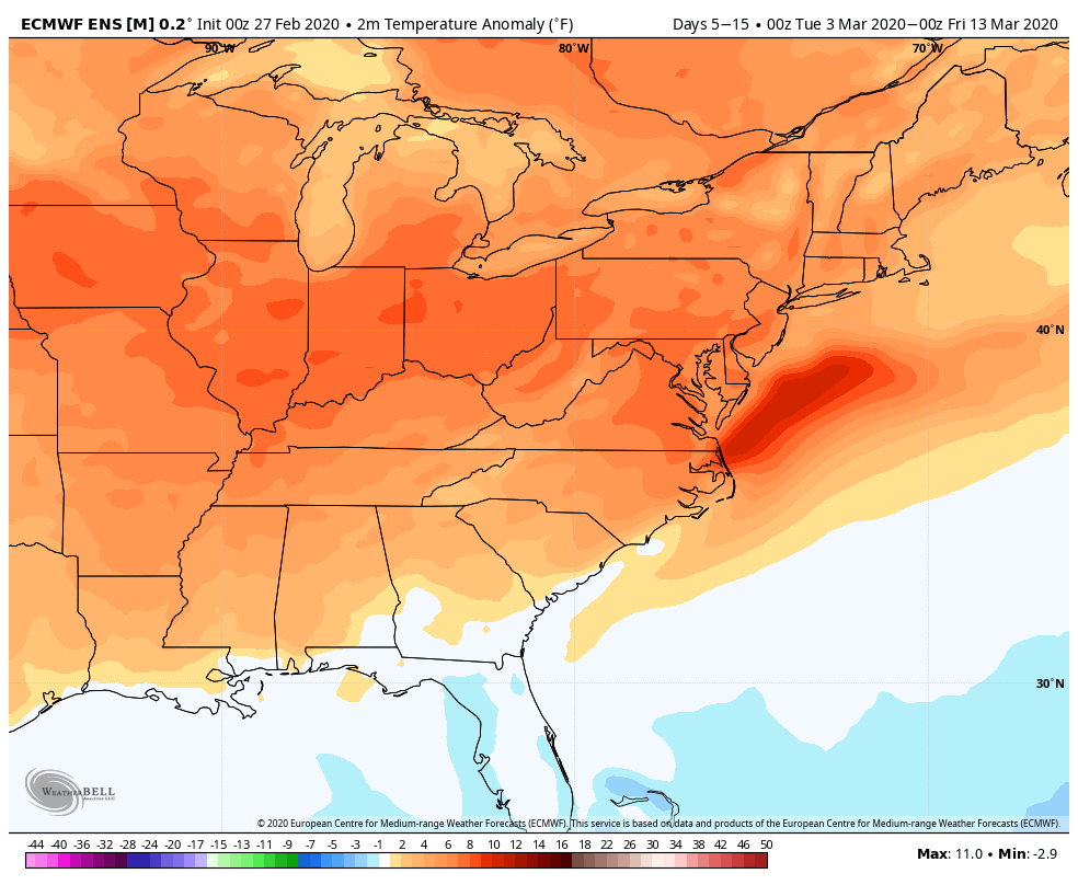
If you’re looking for early-March snow, there’s not too much potential for that next workweek. There’s a low risk of something next weekend. Right now, models show about a 20% chance of snow in Southern New England. Long-range models suggest warmer than normal weather from the first weekend of March leading up to near St. Patrick’s Day.