March 22 – Snow to rain on Monday
After the very mild and basically snow-free January and February, I started wonder if we would bookend this winter with most of the snow threats at the beginning and end. You may remember it started early this year with several November snow chances. Well, it looks like there will be at least one, and probably two, snow threats for most of Southern New England in the last full week of March.
The weekend ends with a dry and cool Sunday. Look for temps near 40° in the afternoon as skies stay partly to mostly sunny. It will stay dry through Sunday night. The temperature dips below 30° early Monday morning.

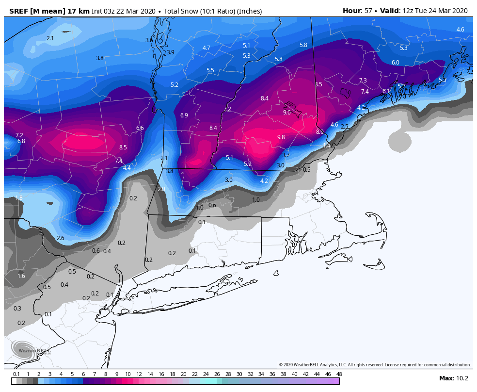
Snow spreads in from west to east from late Monday morning in western CT to early to mid afternoon in RI. It will likely change to rain very quickly near the coast, and accumulation is unlikely on roads during the day in all but the highest elevations of NW/NE CT and possibly NW RI. The I-95 corridor will likely not see much snow accumulation at all before a change to rain.

Rain may be heavy at times late Monday into Monday night. The rain will be gone by dawn on Tuesday, and the low temperature will be above freezing – so no icy conditions are expected. It will spike into the 50s on Tuesday afternoon. Enjoy it, because another storm makes a run at Southern New England in the midweek. More rain and/or snow is likely on Wednesday into Wednesday night. A best-case scenario is a raw/rainy Wednesday afternoon. In the worst-case, there could be heavy/wet snow. Right now, it looks more wet than white.
It dries out on Thursday and Friday. Yet another storm system could bring more rain next weekend. It’s definitely and unsettled end to March!


