April 10 – Quiet Easter weekend; Stormy early next week
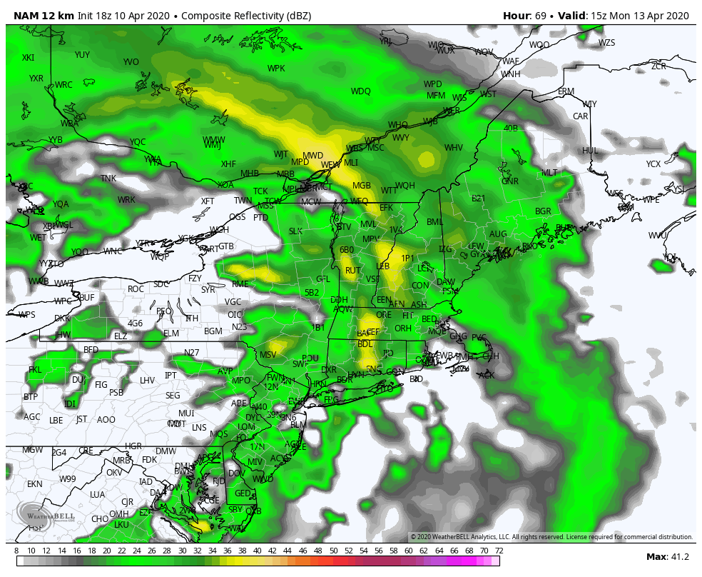
UPDATE: The threat of damaging winds in Southern New England is increasing for Monday. Widespread 50+ mph gusts are possible during the day when heavy downpours and possible thunderstorms roll though.
EARLIER
It has been a wild spring so far with snowflakes flying in mid-April and wild temperature swings. A huge storm system spinning in Canada sent waves of rain and snow showers at Southern New England on Friday. The weather quiets down considerably this weekend, but it will not stay dry for long.
Look for highs in the low 50s with some sun and breezy conditions on Saturday. Sunday will feature increasing clouds with highs in the low to mid 50s. Rain should hold off for most of the day, but a few showers are possible by late in the day.
Rain chances increase on Monday with strong southerly winds ahead of a cold front. The temperature may reach the low 60s, but the rain could be heavy at times, and thunderstorms are possible.

The rain threat ends late Monday, but not before 0.75-1.5″ rain falls in Southern New England. The best bet for 1-1.5″ rain is in Connecticut. There will be a break in the action on Tuesday, and with some sun it may reach the low 60s.
The wild weather changes continue in the midweek as a storm shooting out of the Southeast and off the Mid-Atlantic coast brings cold rain close to Southern New England. It looks like the storm will move far enough north for a wet Wednesday with temps in the upper 30s to low 40s! There might even be some snow mixed in at higher elevations.
That storm moves away and the rest of the week looks cool and dry. Expect highs in the upper 40s to low 50s Thursday through Saturday. The overall weather pattern into late April looks relatively cool and wet in the Northeastern United States.


