There may not be any more snow this spring in Southern New England, but the unsettled and cool weather pattern persists through the end of the month. The workweek starts with dry weather on Monday. It will not be as mild as Sunday was. A strong cold front approaching on Tuesday will bring a line of showers and thunderstorms from west to east across Southern New England during the mid to late afternoon.

The weather following that front will be chilly and windy on Wednesday. It stays cool on Thursday with dry skies. A storm system moving out of the Southeast off the Mid-Atlantic coast will make a run at Southern New England with chilly rain possible on Friday.
The break between storm threats will not last long as another system approaches by the end of the weekend. The way it looks right now, there could be rain again by late Saturday, and the rain threat continues on Sunday.
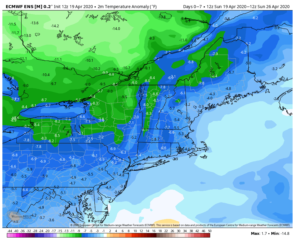
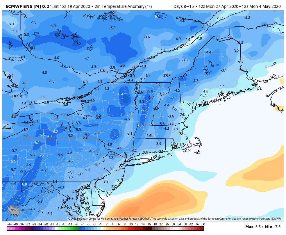
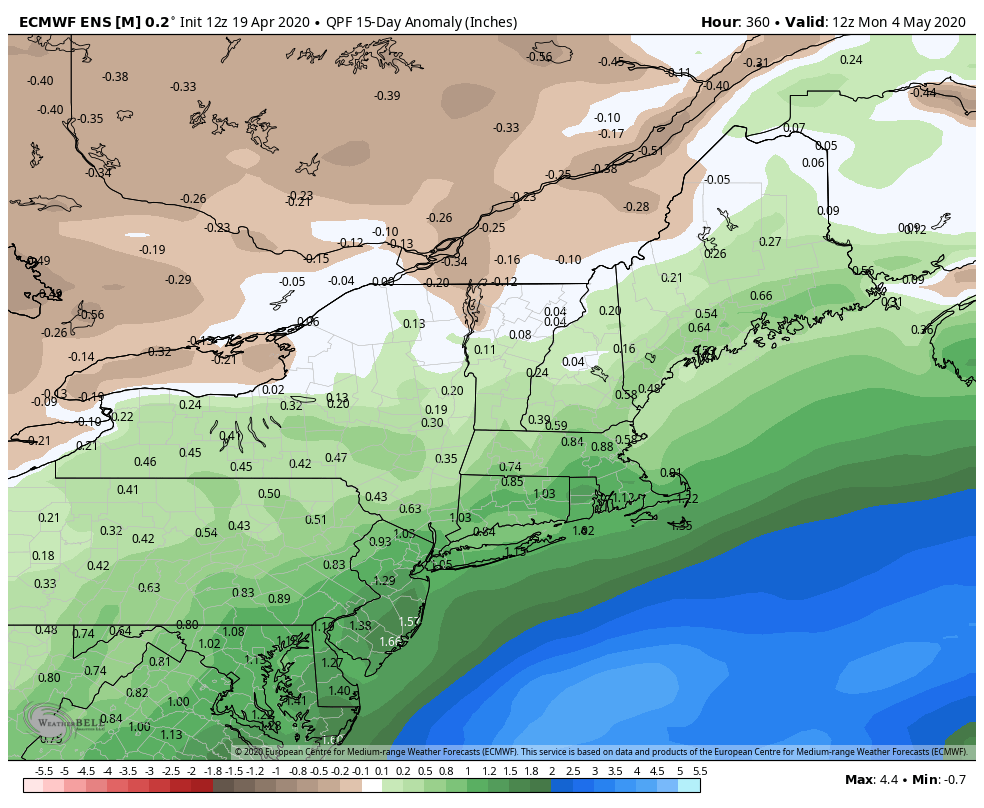
The general weather pattern looks very cool this week, and cool again next week. The overall rain pattern favors above normal precipitation in the next two weeks.