It has not been a nice spring in Southern New England, and a generally lousy weather pattern continues in the upcoming week. A storm lasts from Sunday through Monday with occasional rain and breezy/cool conditions. The temperature may reach the low 50s on Sunday as rain arrives, but it will be stuck in the low to mid 40s on Monday with a north-northeast wind between 10-25 mph.

0.5-1 inch of rain is most likely between Sunday and Monday. There will likely be some snow mixing in at higher elevations. No snow accumulation is expected until you get into the Berkshires and northern New England. It’s yet another wintry event in late-April after a winter that did not feature much snow in New England.
Tuesday looks mostly cloudy, brisk and cool for late-April, with highs only in the upper 40s to low 50s. It will be milder and dry on Wednesday, but not exactly warm as the temperature only reaches the mid 50s. Another storm system approaches from the west on Thursday, and that brings more rain which may be heavy at times Thursday night.

More than an inch of rain is possible from Thursday afternoon into Friday morning. The weather looks drier and milder on Friday afternoon, with highs not far from 60. It’s early, but the outlook for next weekend is for decent weather with dry conditions on Saturday and a mainly dry Sunday before rain threatens again. Highs could be in the 60s next weekend – a welcome sight.
We may have to soak in any warmth and dry weather we get because the long-range forecast through Mother’s Day favors relatively wet and cool conditions in most of the Northeastern United States. Had this pattern been around a few months ago, it would have been a totally different story this winter with much more snow and cold weather.

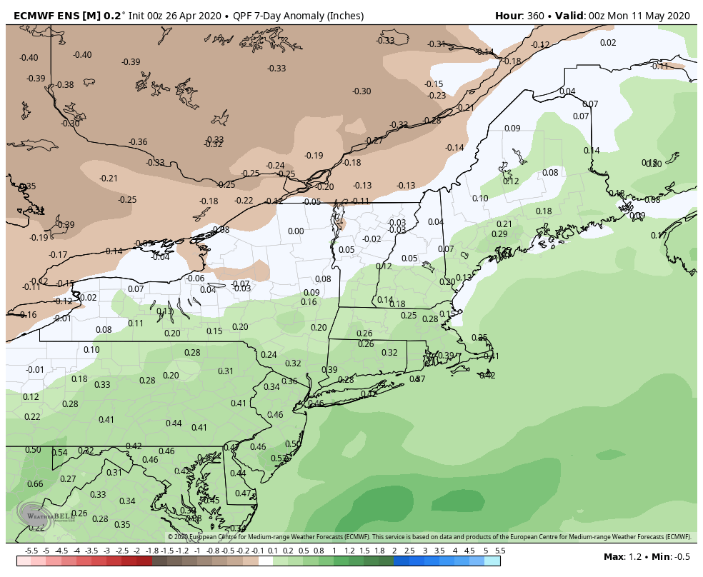
Looking way down the road into the rest of May and early June, the pattern favors continued wetter than normal weather along the Eastern Seaboard. The temperature trend does not look quite as chilly, but it’s also not warmer than normal.


